Canyon Mtn
| Site Name: | Canyon Mtn | 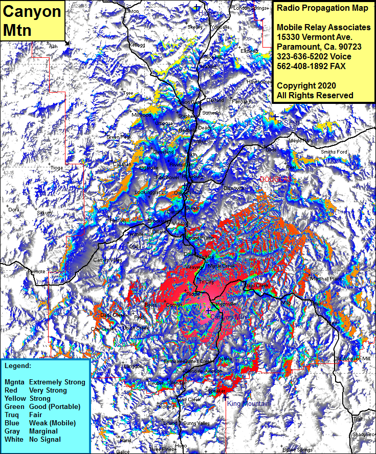 Canyon Mtn Coverage |
| Latitude: | 042 54 06.4N | 42.9017778 |
| Longitude: | 123 17 11.3W | -123.2864722 |
| Feet | Meters | |
| Ground Elevation: | 3344.0 | 1019.3 |
| HAAT: | 1719.6 | 524.1 |
| City: | Canyonville | |
| County: | Douglas | |
| State: | Oregon |
This is not an MRA Owned Site. For space rental contact the site owner.
Do you own or manage this site? Click Here
Would you like to add a site to the Google Earth Map?? Click Here
Site Coverage: Coverage of Canyonville, Milo, Tiller, Days Creek, Marsh, Riddle, Tri City, Weaver, Myrtle Creek, Ruckles, Dole, Round Prarie, Eugene, Winston, Brockway, Tenmile, Olalla, Reston, Cornutt, Byers, Azalea, Galesville, Quines Creek, Fernvale, Glendale Jct, Glendale, Rebuen, Sunny Valley