Chehelam
| Site Name: | Chehelam | 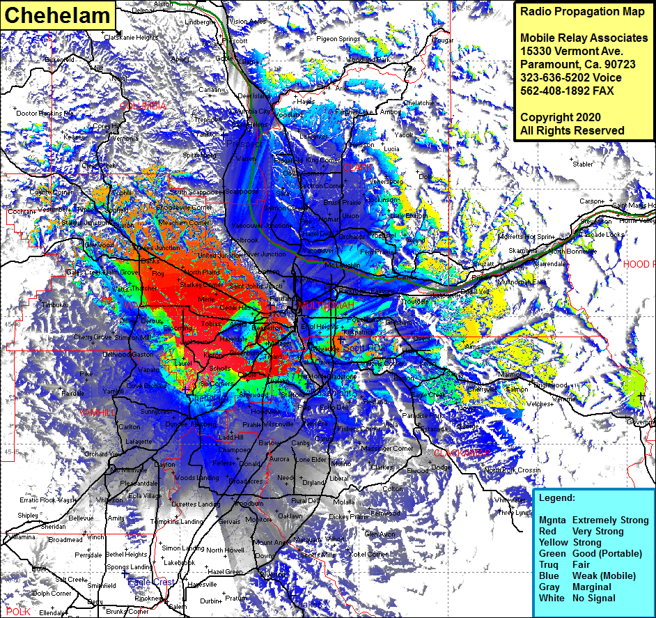 Chehelam Coverage |
| Latitude: | 045 21 23.6N | 45.3565556 |
| Longitude: | 122 59 03.8W | -122.9843889 |
| Feet | Meters | |
| Ground Elevation: | 1216.0 | 370.6 |
| HAAT: | 932.9 | 284.4 |
| City: | Newberg | |
| County: | Yamhill | |
| State: | Oregon |
This is not an MRA Owned Site. For space rental contact the site owner.
Do you own or manage this site? Click Here
Would you like to add a site to the Google Earth Map?? Click Here
Site Coverage: Coverage of Buckhaven, Six Corners, Scholls, Kinton, Jacktown, Farmington, Blooming, Hillsboro, Newton, Aloha, Hazeldale, Jacktown, Fanno, Robinson, Tigard, Durham, Cipole, Sherwood, Votaw, Chehalem, Springbrook, Newberg, Dundee, Latayette, Saint Paul, Weston Landing, Pleasantdale, Eola Village, Unionvale, Whites Landing, Orchard iew, Carlton, Yamhill, Lunnville, Pike, Fairdale, Cherry Grove, Stimson Mill, Dilley, Detour, Blooming, Verboort, Thacher, Watts, Schefflin, Christie, Kansas City, Banks, Navies Jct, Manning, Buxton, Scofield, Tophill, Meacham Corner, Snooseville Corner, Valle Vista, Bendemeer, Bonny Slope, Portland, Norwood, Prahl, Ladd Hill, Fargo, Donald, Broadacres, Woodburn, Oaklawn, Yoder, Dryland, Liberal, Macksburg, Fishers Corner, Carus and more …..