Glenada
| Site Name: | Glenada | 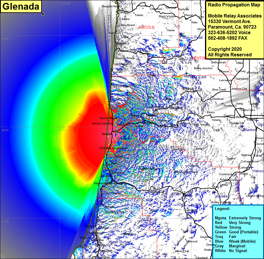 Glenada Coverage |
| Latitude: | 043 57 19.9N | 43.9555278 |
| Longitude: | 124 04 30.6W | -124.0751667 |
| Feet | Meters | |
| Ground Elevation: | 731.0 | 222.8 |
| HAAT: | 574.8 | 175.2 |
| City: | Florence | |
| County: | Lane | |
| State: | Oregon |
This is not an MRA Owned Site. For space rental contact the site owner.
Do you own or manage this site? Click Here
Would you like to add a site to the Google Earth Map?? Click Here
Site Coverage: Coverage of Florence, Glenada, Siboco, Canary, North Beach, Westlake, Ada, Booth, Bass, Kroll, Brenham, Gardiner, Franz, Reedsport, Winchester Bay, Tharp, Lakeside, Shutter Landing, Ash, Tiernan, Minerva, Cushman, Haceta Jct, Heceta Beach, Searose Beach, Waconda Beach, Waldport, Bayview, Mapleton, Firo, Rainrock, Siuslaw, Minerva