Grizzly Butte
| Site Name: | Grizzly Butte | 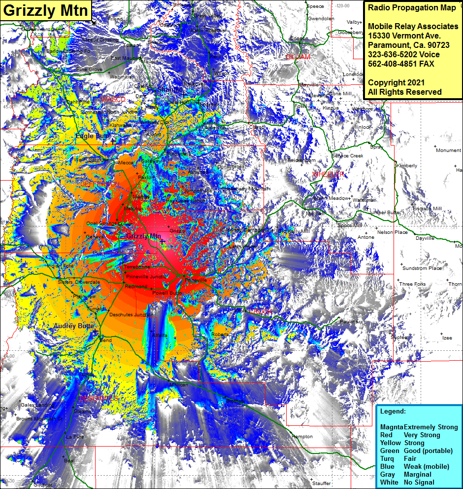 Grizzly Butte Coverage |
| Latitude: | 044 26 16.1N | 44.4378056 |
| Longitude: | 120 57 18.1W | -120.9550278 |
| Feet | Meters | |
| Ground Elevation: | 5612.0 | 1710.5 |
| HAAT: | 2208.0 | 673.0 |
| City: | Prineville | |
| County: | Crook | |
| State: | Oregon |
This is not an MRA Owned Site. For space rental contact the site owner.
Do you own or manage this site? Click Here
Would you like to add a site to the Google Earth Map?? Click Here
Site Coverage: Coverage of Prineville, Powell, Redmond, Prineville Jct, Terrabonne, Opal City, Opal Springs, Geneva, Metolius, Lakin Place, Old Kelly Mill, Grizzly, Hay Creek Ranch, Jumpoff Joe, Ashwood, Donnybrook, Madras, Masras Station, Paxton, Gateway, Willowdale, South Jct, Axford, Whiskey Dick, Hardy, North Jct, Dant, Mhells Crossing, Bakeoven, Wapinitia, Pine Grove, Dahl Pine, Simnasho, Kishwalks, Mecca, Warm Springs, Cloverdale, Sister, Plainview, Fumalo, Sisters, Indian Ford, Tumalo, Bend, Lava, Stearns, Gales Landing, Robideau Landing, Elk Lake, Jack Shelter, Beal, Crescent, Gilchrist, Millican, Brothers, Alfalfa, Roberts, Barlow Crossing, Steeds Crossing, Wamic, Bourbon, Kent, WIlcox, Donnybrook