Hagan
| Site Name: | Hagan | 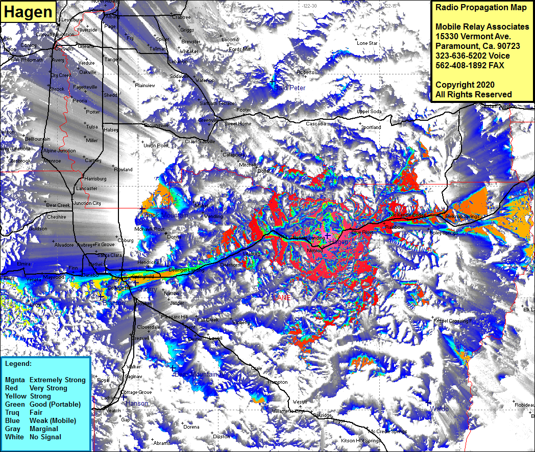 Hagan Coverage |
| Latitude: | 044 08 21.0N | 44.1391667 |
| Longitude: | 122 24 37.7W | -122.4104722 |
| Feet | Meters | |
| Ground Elevation: | 3344.0 | 1019.3 |
| HAAT: | 1301.0 | 396.6 |
| City: | Nimrod | |
| County: | Lane | |
| State: | Oregon |
This is not an MRA Owned Site. For space rental contact the site owner.
Do you own or manage this site? Click Here
Would you like to add a site to the Google Earth Map?? Click Here
Site Coverage: Coverage of Blue River, Rainbow, McKenzie Bridge, Foley Springs, Belknap Springs, Rennie Landing, Vida, Leaburg, Deerhorn, Walterville, Mitchell, Calapooia, Holley, Greenville, Sweet Home, Foster, Crawfordsville, Bellinger Landing, Thursten, Springfield, Springfield Jct, Eugene, Bethel, Danebo, Finn, Maywood, Venete, Elmire, Alvadore, Awbrey, Irving, Fir Grove, Santa Clara, Coburg, Swain, Bear Creek, Junction City, Lancaster, Harrisburg, Rowland, Cartney, Monroe, Alpone Jct, Bellfountain Jct, Miller, Tulsa, Halsey, Potter, Plainview, Crowfoot, Fayetteville, Shedd, Greenberry, Shrock, Dry Creek, Avery, Oakville, Tangent, Orleans, Tallman, Fry, Draperville, Brewater, Griggs, Crabtree, Griggs