Hamaker Mtn
| Site Name: | Hamaker Mtn | 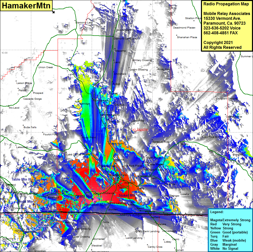 Hamaker Mtn Coverage |
| Latitude: | 042 04 39.2N | 42.0775556 |
| Longitude: | 121 58 24.9W | -121.9735833 |
| Feet | Meters | |
| Ground Elevation: | 6022.0 | 1835.5 |
| HAAT: | 1687.2 | 514.2 |
| City: | Keno | |
| County: | Klamath | |
| State: | Oregon |
This is not an MRA Owned Site. For space rental contact the site owner.
Do you own or manage this site? Click Here
Would you like to add a site to the Google Earth Map?? Click Here
Site Coverage: Coverage of Teeters Landing, Midland, Texum, Keno, Dorris, Somerset, MacDoel, Mt Hebron, Upper Crossing, Gillis, Beswick, Dixie, Worden, Altamont, Hager, Pine Grove, Henley, Gem, Stukel, Dehlinger, Hasley, Lost River, Merrill, Malone, Ainsworth Corner, Kalina, Malin, Dixie, Pinehurst, Mount View, Copco, Hosley, Merrill, Malone, Hatfield, Tulelake, Adam Point, Malin, Kalina, Tuber, Dalton, Lorella, Modoc Point, Chiloquin, Klamath Agency, Calimus, Kirk, Fuego, Fort Klamath, Oakridge. Lake Of The Woods, Copco, Henly, Ager, Lincoln