Harness
| Site Name: | Harness | 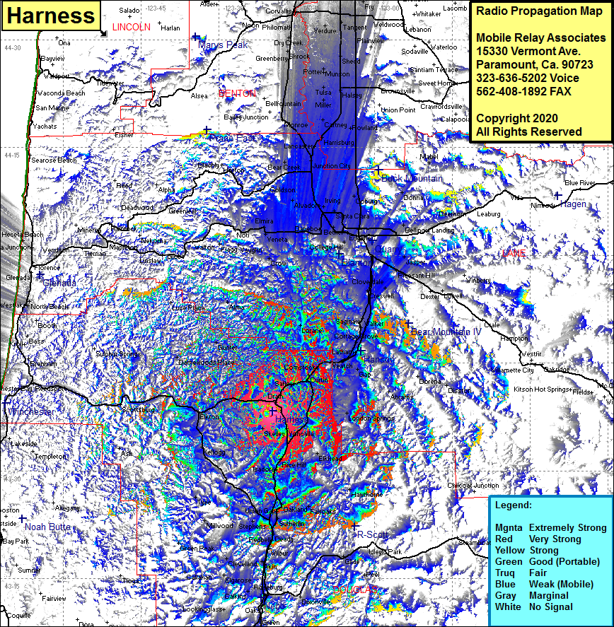 Harness Coverage |
| Latitude: | 043 38 18.4N | 43.6384444 |
| Longitude: | 123 19 35.8W | -123.3266111 |
| Feet | Meters | |
| Ground Elevation: | 1798.0 | 548.0 |
| HAAT: | 1009.7 | 307.8 |
| City: | Leona | |
| County: | Douglas | |
| State: | Oregon |
This is not an MRA Owned Site. For space rental contact the site owner.
Do you own or manage this site? Click Here
Would you like to add a site to the Google Earth Map?? Click Here
Site Coverage: Coverage of Drain, Krewson, Leona, Satley, Anlauf, Curtin, Comstock, Veach, Monett, Latham, Cottage Grove, Saginaw, Walker, Royal, Lorane, Gunter, Gap, London Springs, Elkhead, Yoncalla, Rice Hill, Isadore, Oakland, Union Gap, Sutherlin, Fairoaks, Nonpareil, Hawthorne, Deady, Redbell, Stephens, Umpqua, Mollwood, Green Peak, Tyee, Kellogg, Elkton, Millwood