Heavenly Heights
| Site Name: | Heavenly Heights | 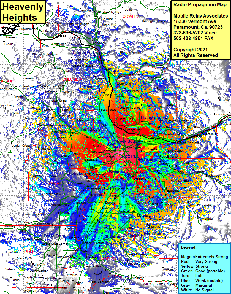 Heavenly Heights Coverage |
| Latitude: | 045 29 23.1N | 45.4897500 |
| Longitude: | 122 41 51.8W | -122.6977222 |
| Feet | Meters | |
| Ground Elevation: | 1026.0 | 312.7 |
| HAAT: | 785.6 | 239.4 |
| City: | Sentinel Hill | |
| County: | Multnomah | |
| State: | Oregon |
This is not an MRA Owned Site. For space rental contact the site owner.
Do you own or manage this site? Click Here
Would you like to add a site to the Google Earth Map?? Click Here
Site Coverage: Coverage of Portland, West Union, North Plains, Glencoe, Davies Jct, Banks, Schefflin, Glenwood, Balm Grove, Watts, Timbucktu, Buxton, Scofield, Tophill, Timber, Coyote Corner, Clear Creek, Treharne, Keasey, Corey Hill, Veronia, Snooseville Corner, South Scappoose, Scappoose, McNutty, Spitzenberg, Columbia City, Canaan, Woodland, Hayes, Etna, Ariel, Woodland Park, Yale, Cougar, Amboy, Chelatchie, Yacolt, Lucia, Dole, Venersborg, Hockinson, Creswell Heights, Ireland, Fairview, Troutdale, Bridal Veil, Multnomah Falls, Oneonta, Dodson, North Bonneville, Gresham, Orient, Aims, Haley, Kelso, Sandy, Cherryville, Dover, George, Estacada, Tracy, Dodge, North Fork Crossing, Colton, Fernwood, WIlhoit, Glen Avon, Molalla, Union Mills, Dryland, Oaklawn, Woodburn, Gervais, Mount Angel, Scotts Mills Glen Avon, Unionvale, Simon Landing, Kelzer, Woodburn, Eagle Crest Corner, Roberts, Rosedale, Judson Landing, Young, Aumsville, Stayton, West Stayton, Carlton, Yambill, Sunnycrest, Newberg, Pike