Hinkle
| Site Name: | Hinkle | 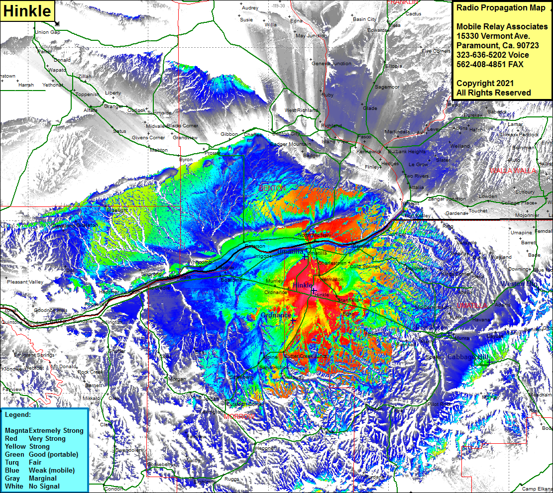 Hinkle Coverage |
| Latitude: | 045 47 48.9N | 45.7969167 |
| Longitude: | 119 18 35.9W | -119.3099722 |
| Feet | Meters | |
| Ground Elevation: | 617.0 | 188.1 |
| HAAT: | 54.8 | 16.7 |
| City: | Bucks Corner | |
| County: | Umatilla | |
| State: | Oregon |
This is not an MRA Owned Site. For space rental contact the site owner.
Do you own or manage this site? Click Here
Would you like to add a site to the Google Earth Map?? Click Here
Site Coverage: Coverage of Hinkle, Hermiston, Cornel Place, Umatilla, Cold Springs Jct, Berrian, North McNary, Juniper, Holdman, Stanfield, Echo, Nolin, Barnhart, Rieth, Sparks, Munra, Fulton, Havana, Adams, Helix, Butter Creek Jct, Sand Hollow, Alpine, Strawberry, Ella, Cutsforth Corner, Ione, Morgan, Cecil, Moona, McCredie, Sixprong, Castle, Whitcomb, Messner, Boardman, Alderdale, Paterson, Fairview, Velby, Port Kelly, Dot, Bluelight, Finley, Hedges, Kermewick, Island View, Richland, Pasco, Burbank Heights, Martindale, Ash, Le Grow, Slater, Welland, Adkins, Hatch, Babcock, Lee, Harvey, Levey, Sagemoor, Mathews Corner, Glade