Jett Creek
| Site Name: | Jett Creek | 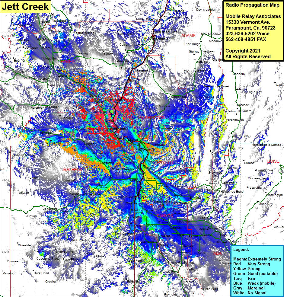 Jett Creek Coverage |
| Latitude: | 044 25 52.8N | 44.4313333 |
| Longitude: | 117 14 58.4W | -117.2495556 |
| Feet | Meters | |
| Ground Elevation: | 4964.0 | 1513.0 |
| HAAT: | 1685.2 | 513.6 |
| City: | Huntington | |
| County: | Baker | |
| State: | Oregon |
This is not an MRA Owned Site. For space rental contact the site owner.
Do you own or manage this site? Click Here
Would you like to add a site to the Google Earth Map?? Click Here
Site Coverage: Coverage of Lime, Huntington, Eaton, Weiser, Feltham, Crystal, Wood, Rebecca, Payette Heights, Payette, Washoe, Ontario Heights, Ingard, Gayway Corner, Fruitland, Arcadia, Nyssa, Apple Valley, Parma, Overstreet, Owyhee, Adrian, Napton, Notus, Wilder, Greenleaf, Huston, Claytonia, Marsing, Riverside, Midway, Karcher Jct, Fischer, Nampa, Kings Corner, Deal, Swartz Corner, Deal, Kuna, Bowmont, Westma, Mora, Sonna, Meridian, Beatty, Cloverdale, Ustick, Eagle, Garden City, Boise, Hillcrest, Barber, Blacks Creek, Leona, Napton, Luse, Hope, Little Valley, Harper, Namorf, Jonesboro, Juntura, Westfall, Lockhart Crossing, Westfall, Bonita, Ironside, Lockhart Crossing, Hereford, Bridgeport, China Town, Nelson, Durkee, Oxman, Pleasant Valley, Salisbury, Auburn, McEwan, Sumpter, WIngville, Keating, Sparta, New Bridge, Richland, Cornucopia, Homestead, Copperfield, Sturgill, Mineral, Still, Crawford Place, Lancaster, Jamieson, Brogan, Huntington Jct, Amelia, Eldorado, Ontario Heights, Middleton, Eagle, Ustick, Garden CIty, Boise, Hillcrest, Barber