John Day I
| Site Name: | John Day I | 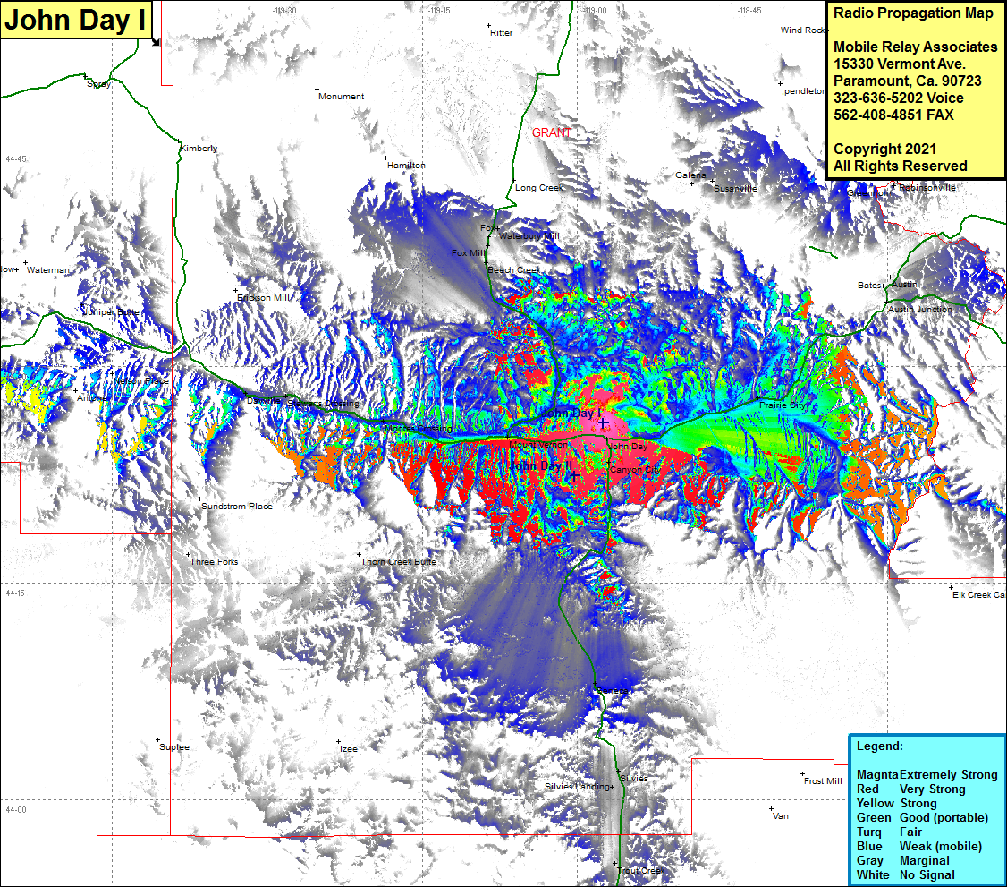 John Day I Coverage |
| Latitude: | 044 26 04.2N | 44.4345000 |
| Longitude: | 118 57 31.2W | -118.9586667 |
| Feet | Meters | |
| Ground Elevation: | 3881.0 | 1182.9 |
| HAAT: | -110.6 | -33.7 |
| City: | John Day | |
| County: | Grant | |
| State: | Oregon |
This is not an MRA Owned Site. For space rental contact the site owner.
Do you own or manage this site? Click Here
Would you like to add a site to the Google Earth Map?? Click Here
Site Coverage: Coverage of John Day, Canyon City, Prarie City, Austin Junction, Bates, Seneca, Silvies Landing, Trout Creek, Three Forks, Moores Crossing, Dayville, Nelson Place, Junction Butte, Spoos Mill, Beach Creek, Fox, Waterbury Mill