John Day II
| Site Name: | John Day II | 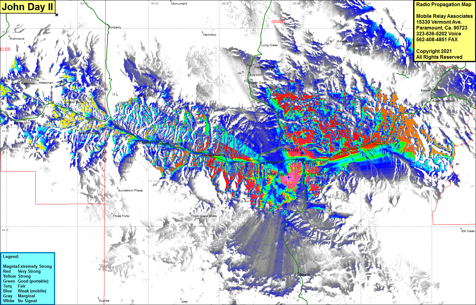 John Day II Coverage |
| Latitude: | 044 22 25.5N | 44.3737500 |
| Longitude: | 119 00 15.6W | -119.0043333 |
| Feet | Meters | |
| Ground Elevation: | 4102.0 | 1250.3 |
| HAAT: | -88.8 | -27.1 |
| City: | John Day | |
| County: | Grant | |
| State: | Oregon |
This is not an MRA Owned Site. For space rental contact the site owner.
Do you own or manage this site? Click Here
Would you like to add a site to the Google Earth Map?? Click Here
Site Coverage: Coverage of John Day, Canyon City, Prarie City, Austin Junction, Bates, Seneca, Thorn Creek Butte, Moores Crossing, Dayville, Nelson Place, Junction Butte, Spoos Mill, Beach Creek, Fox, Waterbury Mill, Juniper Butte, Blann Meadow