KGW
| Site Name: | KGW | 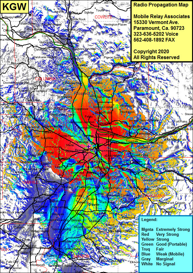 KGW Coverage |
| Latitude: | 045 31 21.0N | 45.5225000 |
| Longitude: | 122 44 46.0W | -122.7461111 |
| Feet | Meters | |
| Ground Elevation: | 1125.0 | 342.9 |
| HAAT: | 925.6 | 282.1 |
| City: | Portland | |
| County: | Multnomah | |
| State: | Oregon |
This is not an MRA Owned Site. For space rental contact the site owner.
Do you own or manage this site? Click Here
Would you like to add a site to the Google Earth Map?? Click Here
Site Coverage: Coverage of Portland, Hollywood, Alameda, Millina, University Park, Champ, University Park, Peninsula Jct, North Portland, Whitwood Court, Linnton, Miller, Burlington, Holbrook, Johnson Crossing Scappoose, Snooseville Corner, Meacham Corner, Banks, Roy, Vadis, Mountaindale, North Plains, Bendemeer, Bethany, Merle, Quantama, Hillsboro, Mahan, Carnation, Blooming, Forest Grove, Dilley, Patton, Gaston, Laurelwood, Lunnville, Yamhill, Carlton, Saint Joseph, Lafayette, Dundee, Sunnycrest, Newburg, Springbrook, Sherwood, Cipole, Hermah, Bull Mountain, Kinton, Scholls, Robinson, Beaverton, Maplewood, Metzger, Tigard, Bryant, Norwood, Mulby, Wilsonville, Curtis, Butteville, Fargo, Barlow, Canby Coalca, Advance, Pulp, Willamette, Echo Deli, Redland, Fishers Corner, Carus, Massinger Corner, Blurock Landing, Morgan Landing, Johnson Crossing, Scappoose, Good Hope, Union, Sifton, Orchards, Fisher, Barlett Landing, Scotton Corner, Deer Island, Waterview, Saint Helens, McNulty, Warren, Yankton, Trenholm, Cannan, Hayes, Etna, Ariel, Charter Oak, Pine Grove, Charer Oak, Crawford, Venersborg, Little Elkhorn, Fern Prairie, Gresham, Hillsview, Haley, Harmony and more…