King Mountain
| Site Name: | King Mountain | 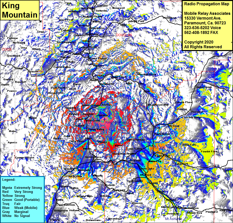 King Mountain Coverage |
| Latitude: | 042 41 30.8N | 42.6918889 |
| Longitude: | 123 13 48.7W | -123.2301944 |
| Feet | Meters | |
| Ground Elevation: | 5274.0 | 1607.5 |
| HAAT: | 2666.3 | 812.7 |
| City: | Golden | |
| County: | Josephine | |
| State: | Oregon |
This is not an MRA Owned Site. For space rental contact the site owner.
Do you own or manage this site? Click Here
Would you like to add a site to the Google Earth Map?? Click Here
Site Coverage: Coverage of Speaker, Golden, Placer, Winona, Glendale, Glendale Jct, Reuben Langdon, Pollard, Wolf Creek, Golden, Placer, Sunny Valley, Leland, Hugo, Three Pines, Merlin, Dimmick, Grants Pass, Starvation Heights, Sams Valley, Fernvale, Glendale Jct, Alesville, Quines Creek, Azalea, Canyonville, Riddle, Cornutt, Milo, Sams Valley, Tolo, Gold Hill, Table Rock, White City, Eagle Point, Tolo, Seven Oaks, Midway, Central Point, Medford, Jacksonville, Voorhies, Phoenix, Talent, Climax, White City, Eagle Point, Brownsboro, Lakecreek, Butte Falls, Shady Grove, Trail, McLeod, Ashland, Mistletoe, Klamath Jct, Steinman, Camas Valley, Reston, Lookingglass, Elgarose, Riverdale, Calking, Roseburg, Winston, Dole, Buckles, Weaver, Myrtle, Tri City, Riddle, Canyonville