KZZR-FM
| Site Name: | KZZR-FM | 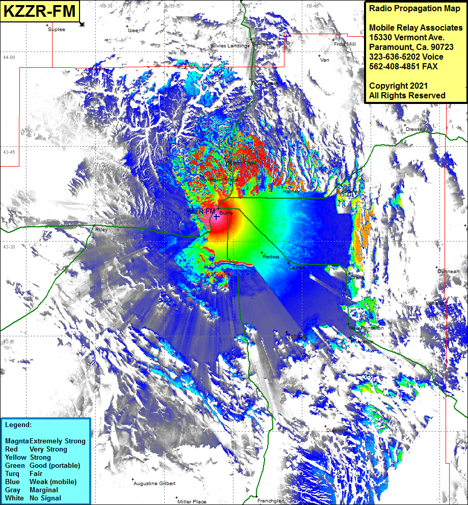 KZZR-FM Coverage |
| Latitude: | 043 33 52.8N | 43.5646667 |
| Longitude: | 119 03 38.2W | -119.0606111 |
| Feet | Meters | |
| Ground Elevation: | 4146.0 | 1263.7 |
| HAAT: | -150.5 | -45.9 |
| City: | Burns | |
| County: | Harney | |
| State: | Oregon |
This is not an MRA Owned Site. For space rental contact the site owner.
Do you own or manage this site? Click Here
Would you like to add a site to the Google Earth Map?? Click Here
Site Coverage: Coverage of Burns, Redess, Lawen, Voltage, Princeton, New Princeton, Crane, Venator, Harney, Buchanan, Sylvester Place, Poison Creek, Riley, Trout Creek, Silvies Landing, Silves, Frost Mill