La Grande
| Site Name: | La Grande | 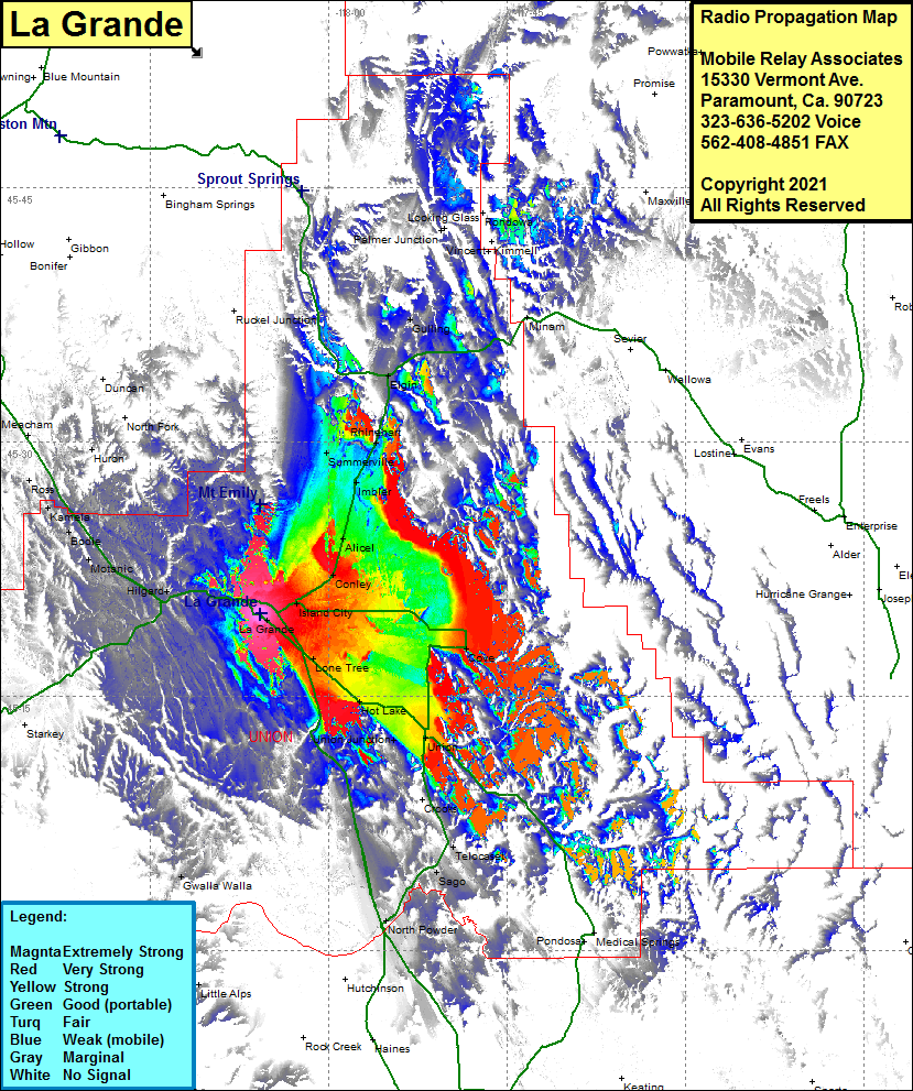 La Grande Coverage |
| Latitude: | 045 19 52.2N | 45.3311667 |
| Longitude: | 118 05 45.0W | -118.0958333 |
| Feet | Meters | |
| Ground Elevation: | 2790.0 | 850.4 |
| HAAT: | -730.0 | -222.5 |
| City: | La Grande | |
| County: | Union | |
| State: | Oregon |
This is not an MRA Owned Site. For space rental contact the site owner.
Do you own or manage this site? Click Here
Would you like to add a site to the Google Earth Map?? Click Here
Site Coverage: Coverage of La Grande, Lone Tree, Hot Lake, Union, Cove, Island City, Conley, Alicel, Imbler, Summerville, Rhinehart, Elgin, Gulling, Hilgard, Motanic, Bodie, Kamela, Ross, Meacham, Camp Elkanah, Little Alps, North Powder, Sago, Telecaset, Crooks