Lone Pine
| Site Name: | Lone Pine | 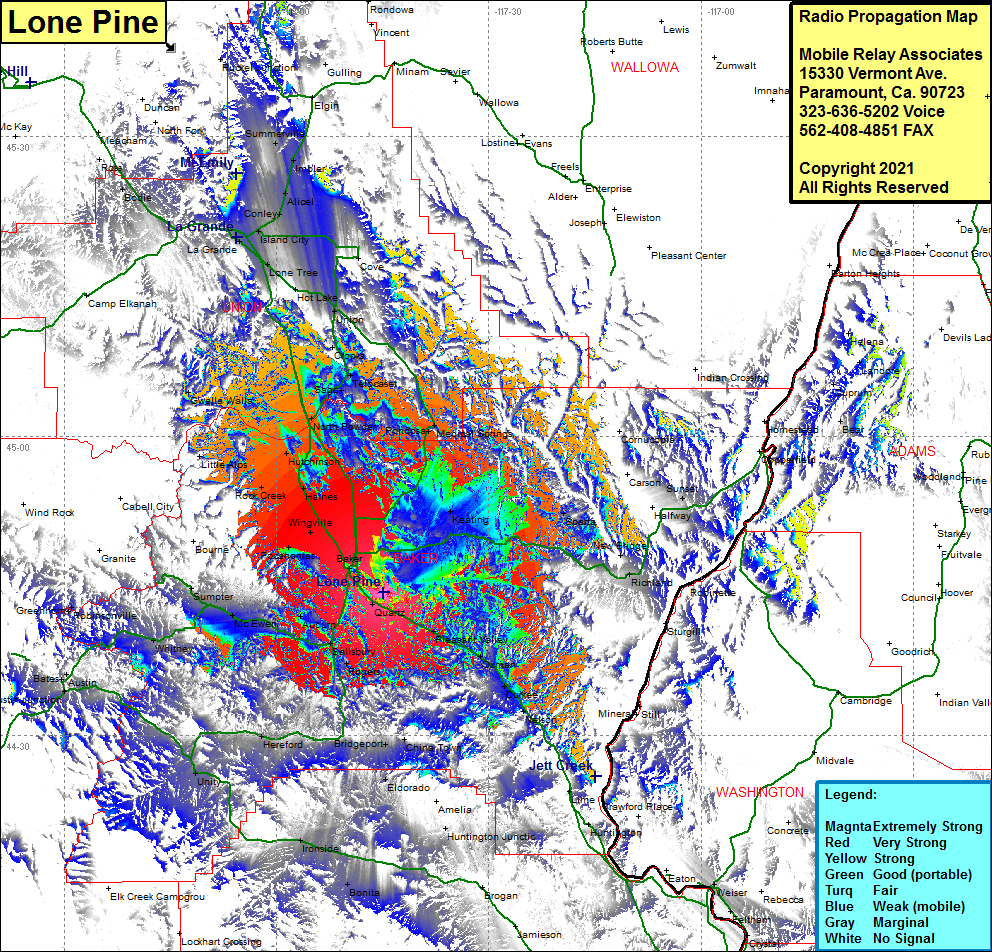 Lone Pine Coverage |
| Latitude: | 044 44 19.0N | 44.7386111 |
| Longitude: | 117 44 50.2W | -117.7472778 |
| Feet | Meters | |
| Ground Elevation: | 5038.0 | 1535.6 |
| HAAT: | 1184.1 | 360.9 |
| City: | Baker | |
| County: | Baker | |
| State: | Oregon |
This is not an MRA Owned Site. For space rental contact the site owner.
Do you own or manage this site? Click Here
Would you like to add a site to the Google Earth Map?? Click Here
Site Coverage: Coverage of Quartz, Baker, Pleasant Valley, Oxman, Duckee, Nelson, Weatherby, Lime, Salisbury, Rogers, Auburn, McEwen, Umpter, Whitney, Bates, Austin, Austin Junction, Unity, Hereford, Bridgeport, Eldorado, Huntington Junction, Pocahontas, Rock Creek, Haines, Hutchinson, Norh Powder, Union Junction, Lone Tree, Hot Lakes, La Grande, Island City, Conley, Alicel, Imbler, Summerville, Rhinehart, Hilgart, Motanic, Bodie, Kamela, Ponderosa, Medical Springs, Keating, Sparta, New Bridge, Richland