Marys Peak
| Site Name: | Marys Peak | 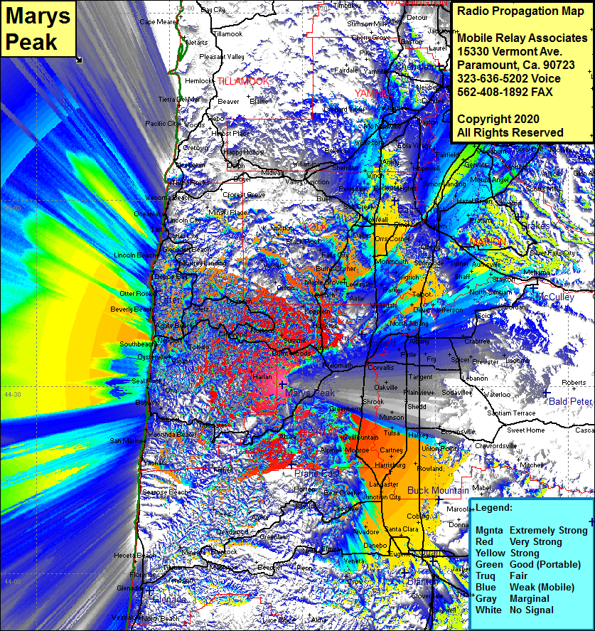 Marys Peak Coverage |
| Latitude: | 044 30 27.3N | 44.5075833 |
| Longitude: | 123 34 31.3W | -123.5753611 |
| Feet | Meters | |
| Ground Elevation: | 3601.0 | 1097.6 |
| HAAT: | 2553.1 | 778.2 |
| City: | Alder | |
| County: | Benton | |
| State: | Oregon |
This is not an MRA Owned Site. For space rental contact the site owner.
Do you own or manage this site? Click Here
Would you like to add a site to the Google Earth Map?? Click Here
Site Coverage: Coverage of Harlan, Salado, Burnt Wiids, Marval, Alder, Pioneer, Toledo, Elk City, Yaquina, Newport, Seal Rock, Ona, Bayview, Wildport, Tidewater, Waconda Beach, San Marine, Yachats, Haceta Beach, Cushman, Florence, Glenada, Westlake, Agate Beach, Beverly Beach, Otter Rock, Depoe Bay, Lincoln Beach, Gleneden Beach, Cutler City, Nelscott, Lincoln City, Oceanlake, Wecoma Beach, Bellfountain, Monroe, Lancaster, Hunction City, Harrisburg, Rowland, Carney, Miller, Tulsa, Halsey, Munson, Fayetteville Shrock, Dry Creek, Vendure, Corvallis, Riveride, Surver, Wells Landing, Monmouth, Clow Corner, Brunks Corner, Roberts Corner, Talbot, Devee, Plainview, Lebanon, Shaff, Stayton, Lakebrook, Simon Landing, Gervais, Woodburn and more….