Mt Hood
| Site Name: | Mt Hood | 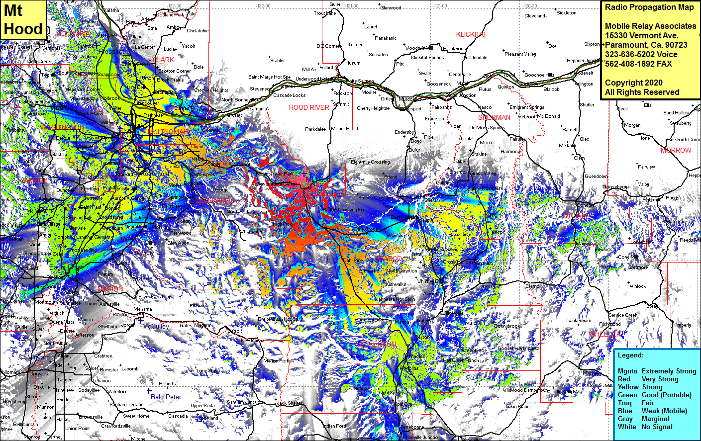 Mt Hood Coverage |
| Latitude: | 045 20 43.2N | 45.3453333 |
| Longitude: | 121 42 42.9W | -121.7119167 |
| Feet | Meters | |
| Ground Elevation: | 7002.0 | 2134.2 |
| HAAT: | 2589.6 | 789.3 |
| City: | Government Camp | |
| County: | Clackamas | |
| State: | Oregon |
This is not an MRA Owned Site. For space rental contact the site owner.
Do you own or manage this site? Click Here
Would you like to add a site to the Google Earth Map?? Click Here
Site Coverage: Coverage of Government Camp, Barlow Crossing, Dahl Pine, Pine Cove, Kishwalks, Wapinitia, Warmic, Steeds Crtossing, Friend, Kingsley, Tygh Valey, Oak Springs, Tusken, Sherar, Eakin, Rutledge, Rosebush, Bourbon, Kent, Wilcox, Bakeoven, Antelope, Paxton, Madras Station, Madras, Metolus, Gooseberry Mtn, Donnybrook, Jumpoff Joe, Brightwood, Marmot, Sandy, Kelso, Eagle Creek, Sunnyside, Portland, Metzger, Hazedale, Bethany, Miller, Burlington, Vancouver Jct, Orchards, Union, Good Hope, Ridgefield, Warren, Saint Helens, Hillsboro, Aloha, Thatcher, Dilley, Yamhill, Carlton, Pleasantdale, Eola Village, McMinnville, Bellevue, Lincoln, Waconda, Gervais, Monitor, Oaklawn, Rural Dell, Dayland, Union Mills, Elwood, Dodge and more …..