Nebo
| Site Name: | Nebo | 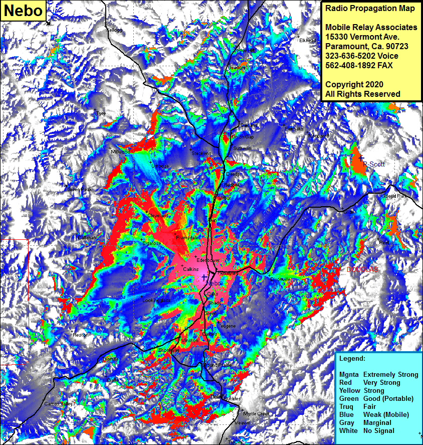 Nebo Coverage |
| Latitude: | 043 12 20.6N | 43.2057222 |
| Longitude: | 123 21 53.1W | -123.3647500 |
| Feet | Meters | |
| Ground Elevation: | 1143.0 | 348.4 |
| HAAT: | 394.9 | 120.4 |
| City: | Roseburg | |
| County: | Douglas | |
| State: | Oregon |
This is not an MRA Owned Site. For space rental contact the site owner.
Do you own or manage this site? Click Here
Would you like to add a site to the Google Earth Map?? Click Here
Site Coverage: Coverage of Roseburg, Edenhower, Akin, Wilbur, Redbell, Deady, Sutherlin, Union Gap, Oakland, Stephens, Umpqua, Millwood, Tyee, Green Peak, Callahan, Cleveland, Riversdale, Elgarose, Melrose, Calkins, Edentower, Lookingglass, Camas Valley, Tenmile, Olalla, Brockway, Winston, Oaks, Shady, Green, Carnes, Round Prarie, Dole, Ruckles, Myrtle Creek, Tri City, Days Creek, Dixonville, Glide, Fairoaks, Nonpareil, Idleyld Park, Marshall Place