Ordnance
| Site Name: | Ordnance | 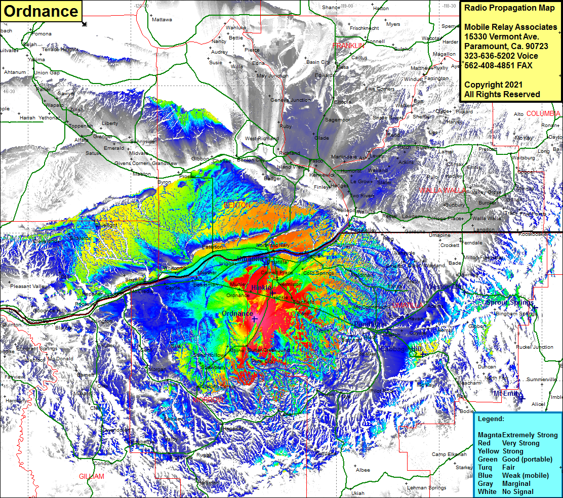 Ordnance Coverage |
| Latitude: | 045 42 35.0N | 45.7097222 |
| Longitude: | 119 23 55.6W | -119.3987778 |
| Feet | Meters | |
| Ground Elevation: | 953.0 | 290.5 |
| HAAT: | 170.5 | 52.0 |
| City: | Bucks Corner | |
| County: | Umatilla | |
| State: | Oregon |
This is not an MRA Owned Site. For space rental contact the site owner.
Do you own or manage this site? Click Here
Would you like to add a site to the Google Earth Map?? Click Here
Site Coverage: Coverage of West Highlands, Finley, Richland, Pasco, Glade, Sagemoor, Eltopia, Geneva Jct, Ash, Levey, Hatch, Toppenish, Emerald, Satus, Cleveland, Bickleton, Blulight, Dot, Moona, Sixprong, Heppner Jct, Boardman, Messner, Whitcomb, Paterson, Umatilla, Hermiston, Stanfield, Nolin, Yoakum, Butter Creek Jct, Galloway, Alpine, Strawberry, North McNary, Berrian, Juniper, Port Kelley, Ring, Stanton, Helix, Athena, Weston, Bade, Homly, Fulton, Vinson, Lena, Heppner, Fairview, Alpine, Ella, Cecil, Morgan, Ione, Heppner Jct, Sixprong, Moona, Whitcomb, Messner, Boardman, Dot, Mikkalo, Speece, Gooseberry, Fairview