Quarry
| Site Name: | Quarry | 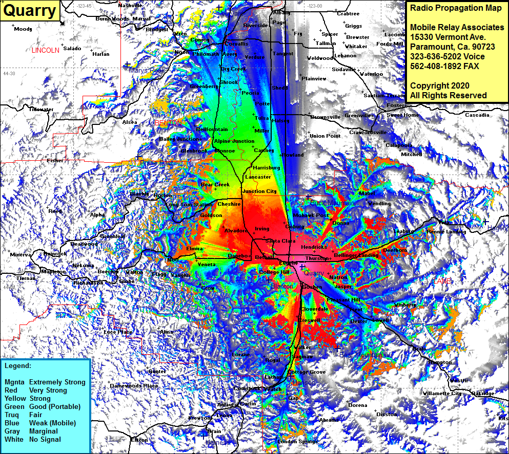 Quarry Coverage |
| Latitude: | 044 02 01.0N | 44.0336111 |
| Longitude: | 123 00 27.0W | -123.0075000 |
| Feet | Meters | |
| Ground Elevation: | 1063.0 | 324.0 |
| HAAT: | 381.0 | 116.1 |
| City: | Eugene | |
| County: | Lane | |
| State: | Oregon |
This is not an MRA Owned Site. For space rental contact the site owner.
Do you own or manage this site? Click Here
Would you like to add a site to the Google Earth Map?? Click Here
Site Coverage: Coverage of Eugene, Santa Clara, Hendricks, Goshen, Cloverdale, Creswell, Bethel, Alvadore, Irving, Coburg, Junction City, Bear Creek, Goldson, Horton, Blachly, Elmira, Veneta, Danebo, Bear Creek, Lancaster, Harrisburg, Cartney, Miller, Bellfountain, Tulsa, Peoria, Vendure, Corvallis, Shrock, Philomath, Neon, Conroy, Wren, Riverside, Pirtle, Albany, Halsey, Rowland, Pleasant Hill, Dexter, Lowell, Hampton, Westfir, Walker, Cottage Grove, Lathan, Veatch, Leaburg, Vida and more….