R-Scott
| Site Name: | R-Scott | 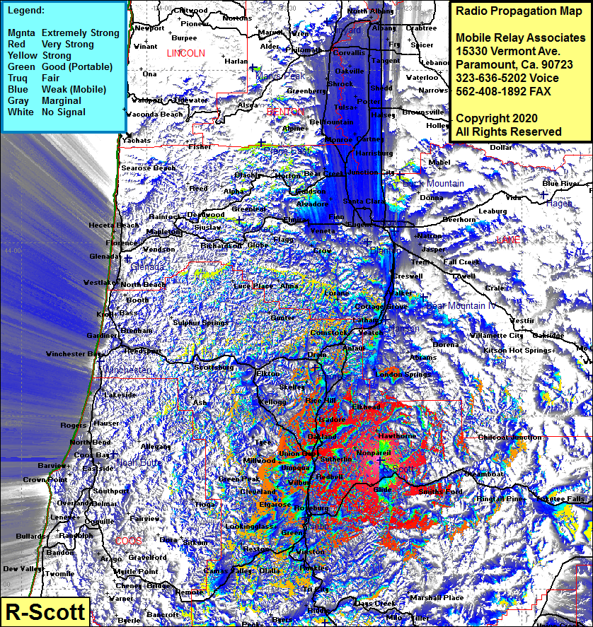 R-Scott Coverage |
| Latitude: | 043 22 18.2N | 43.3717222 |
| Longitude: | 123 03 52.2W | -123.0645000 |
| Feet | Meters | |
| Ground Elevation: | 4114.0 | 1253.9 |
| HAAT: | 2629.6 | 801.5 |
| City: | Glide | |
| County: | Douglas | |
| State: | Oregon |
This is not an MRA Owned Site. For space rental contact the site owner.
Do you own or manage this site? Click Here
Would you like to add a site to the Google Earth Map?? Click Here
Site Coverage: Coverage of Oakland, Deady, Wilbur, Akin, Roseburg, Oak, Green Carner, Winston, Ruckles, Dole, Weaver, Tri City, Dillard, Reston, Olalla, Camas Valley, Lookingglass, Melrose, Callaban, Cleveland, Green Peak, Millwood, Tyee, Union Gap, Isadore, Skelly, Yancalla, Drain, Elkton, Kellogg, Hawthorne, Nonpareil, Smiths Ford, Idleyld Park, Glide, Comstock, Veatch, Latham, Saginaw, Walker, Cresswell, Cloverdale and more…..