Roseburg Mtn Lane
| Site Name: | Roseburg Mtn Lane | 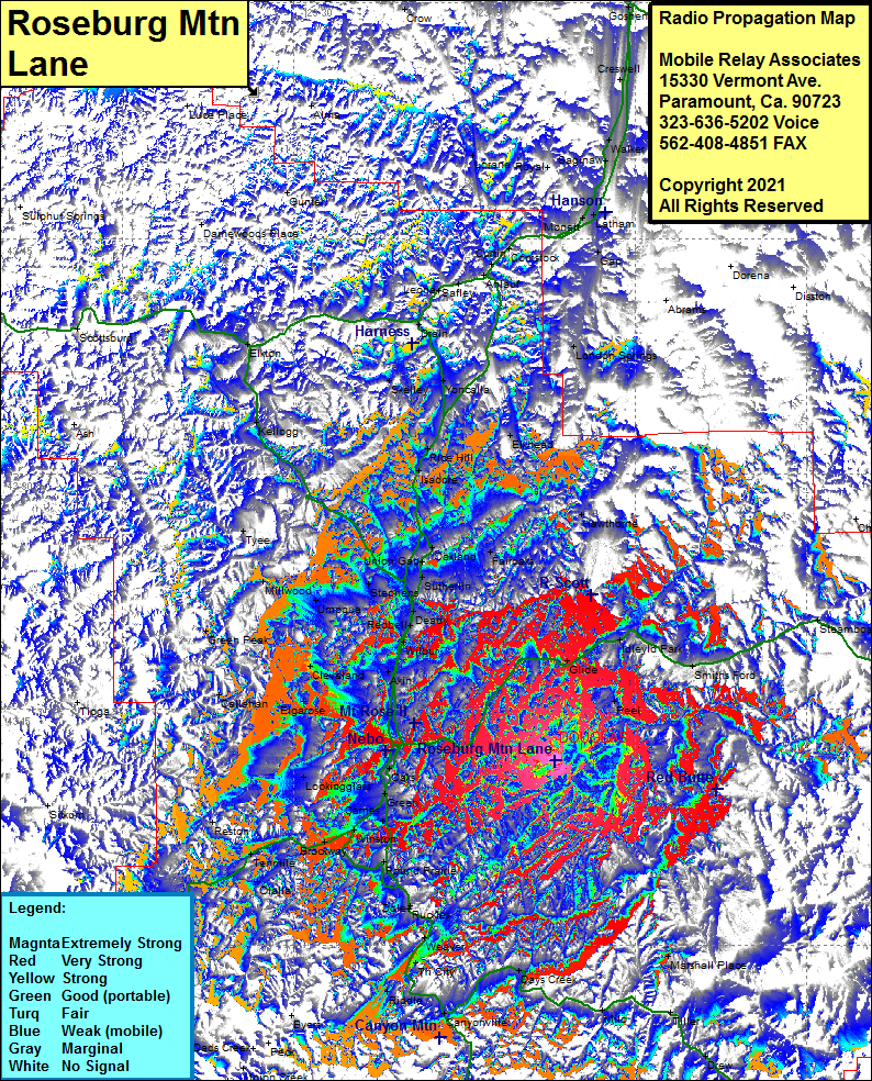 Roseburg Mtn Lane Coverage |
| Latitude: | 043 11 44.6N | 43.1957222 |
| Longitude: | 123 07 02.8W | -123.1174444 |
| Feet | Meters | |
| Ground Elevation: | 3460.0 | 1054.6 |
| HAAT: | 1856.4 | 565.8 |
| City: | Roseburg | |
| County: | Douglas | |
| State: | Oregon |
This is not an MRA Owned Site. For space rental contact the site owner.
Do you own or manage this site? Click Here
Would you like to add a site to the Google Earth Map?? Click Here
Site Coverage: Coverage of Elgarose, Callahan, Akin, Cleveland, Green Peak, Wilbur, Redbell, Deady, Umpqua, Millwood, Tyee, Stephens, Sutherlin, Union Gap, Oakland, Fiaroaks, Isadore, Rice Hill, Elkhead, Yoncalla, Skelley, Kellogg, Elkton, Drain, Krewson, Saffey, Leona, London Springs, Abrams, Elkhead, Hawthorne, Steamboat, Ringtail Pine, Idleyld Park, Smiths Ford, Glide, Peel, Marshall Place, Tiller, Drew, Persist, Old Johnson Mill, Drew, Milo, Days Creek, Canyonville, Cow Creek, Union Creek, Dads Creek, Peck, Byers, Cornutt, Riddle, Tri City, Myrtle Creek, Weaver, Ruckles, Dole, Round Prairie, Camas Valley, Olalla, Tenmile, Reston, Dillard, Brockway, WInston, Round Prairie, Carnes, Green, Oaks, Lookingglass