Shaniko
| Site Name: | Shaniko | 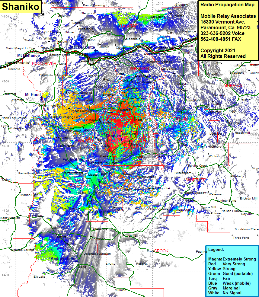 Shaniko Coverage |
| Latitude: | 045 01 30.3N | 45.0250833 |
| Longitude: | 120 50 06.3W | -120.8350833 |
| Feet | Meters | |
| Ground Elevation: | 3653.0 | 1113.4 |
| HAAT: | 781.5 | 238.2 |
| City: | Shaniko | |
| County: | Wasco | |
| State: | Oregon |
This is not an MRA Owned Site. For space rental contact the site owner.
Do you own or manage this site? Click Here
Would you like to add a site to the Google Earth Map?? Click Here
Site Coverage: Coverage of Cross Hollows, Shaniko, Clarno, Old Kelly Mill, Grizzly, Opal City, Opal Springs, Geneva, Culver, Metolius, Madras Sation, Paxton, Hay Creek Ranch, Jumpoff Joe, Gooseberry Mountain, Ashwood, Donnybrook, Mecca, Willowdale, South Junction, Axford, Kishwalks, Whiskey Dick, Shaniko Junction, Antelope, Clarmo, Simnasho, North Junction, Hardy, Dahl Pine, Pine Grove, Wapinitia, Mhells Crossing, Citerion, Dant, Backoven, WIlcox, Kent, Maupin, Cambrai, Oak Springs, Sherar, Tygh Valley, Wamic, Steeds Crossing, Eightmile Crossing, Friend, Kingsley, Oakbrook, Eakin, Wilcox, Kent, Bourbon, Rosebush, Rutledge, Grass Valley, Sinamox, Dike, Erskine, Harmony, Moro, De Moss Springs, Lockit, Kloan, Webfoot, Emigrant Springs, Klondike, Wasco, Thornberry, McDonald, Barnett, Olex, Clem, Speece, Gwendolen, Condon, Mayville