Sprout Springs
| Site Name: | Sprout Springs | 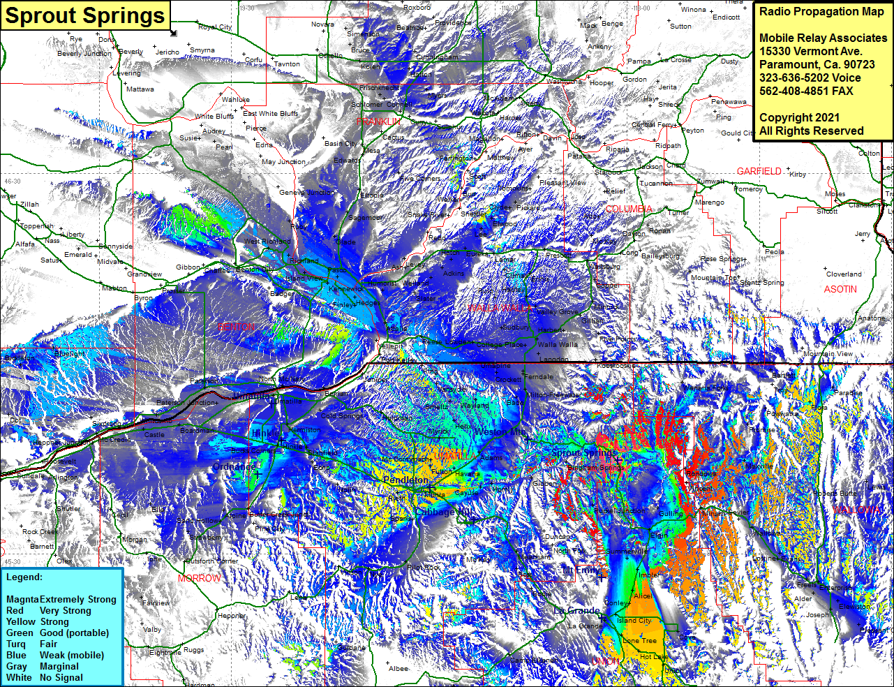 Sprout Springs Coverage |
| Latitude: | 045 44 47.1N | 45.7464167 |
| Longitude: | 118 02 10.7W | -118.0363056 |
| Feet | Meters | |
| Ground Elevation: | 5508.0 | 1678.8 |
| HAAT: | 1446.9 | 441.0 |
| City: | Elgin | |
| County: | Union | |
| State: | Oregon |
This is not an MRA Owned Site. For space rental contact the site owner.
Do you own or manage this site? Click Here
Would you like to add a site to the Google Earth Map?? Click Here
Site Coverage: Coverage of Bringham Springs, Looking Glass, Ruckel Junction, Gulling, Vincent, Rondowa, Minam, Wallowa, Evans, Lostline, Freels, Enterprise, Alder, Elewiston, Joseph, Pleasant Center, Roberts Butte, Lewis, Paradise, Flora, Barlett, Maxville, Promise, Powwatka, Wehsha Forks, Elgin, Rhinehart, Summerville, Imbler, Alicel, Conley, Island City, La Grande, Island City, Lone Tree, Cove, Hot Lake, Union, Crooks, Sago, North Powder, Hutchinson, Haines, WIngville, Rock Creek, Gwalla Walla, Camp Elkanah, Lehman Springs, Meacham, Sparks, Barnhart, Rieth, Munra, Cayuse, Homly, Bonifer, Gibbon, McCommach, Havana, Fulton, Adams, Downing, Blue Mountain, Bade, Barnett, Umapine, Ferndale, Mojonnier, Langdon, Walla Walla, College Place, Sudbury, Kibler, Five Points, Kooshooskier, Dixie, Sapolil, Harbert Valley Grove, Sudbury, Lowden, Touchet, Zangar Jct, Yellepit, Attalia, Two Rivers, Port Kelley, Ring, Gardena, Vansycle, Smeltz, Duroc, Wayland, Helix, Kings Corner, Myrick, Holdman, Hedges, LeGrow, Slater, Burbank Heights, Kennewick, Pasco, Martindale, Island View, Richland, Ruby, Willa, Susie, Audrey, Benton City, Badger Mtn, Chaffee, Gobbon, Whitcomb, Prosser, Edwards, Mesa, Cactus, Connell, Frischknecht, Myers, Hatton, Cunningham, Bruce, Susie, WIlla, Bluelight, Fairview