Steens Mtn
| Site Name: | Steens Mtn | 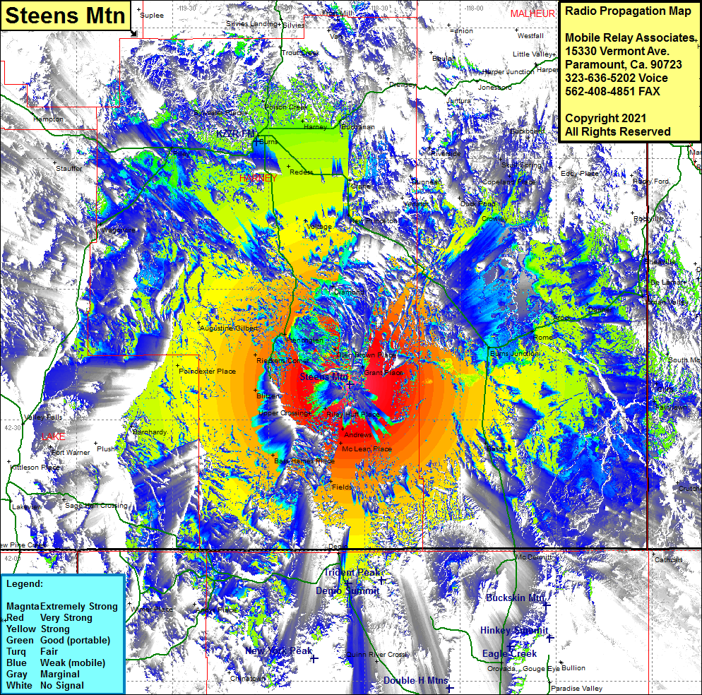 Steens Mtn Coverage |
| Latitude: | 042 38 09.1N | 42.6358611 |
| Longitude: | 118 34 35.3W | -118.5764722 |
| Feet | Meters | |
| Ground Elevation: | 9738.0 | 2968.1 |
| HAAT: | 3794.8 | 1156.6 |
| City: | Frenchglen | |
| County: | Harney | |
| State: | Oregon |
This is not an MRA Owned Site. For space rental contact the site owner.
Do you own or manage this site? Click Here
Would you like to add a site to the Google Earth Map?? Click Here
Site Coverage: Coverage of Glen Brown Place, Grant Place, Frenchglen, Miller Place, Augustine Gilbert, Rieckens Corner, Weaver Place, Blitzen, Upper Crossing, Riley Huff Place, Andrews, McLean Place, Bass Haines Place, Fields, Basque, Burns Junction, Rome, Arock, Danner, Jordan Valley, Barnhardy, Diamond, Voltage, New Princeton, Venator, Dunnean, Crane, Lawen, Redess, Riley, Riverside, Creston, Duck Pond, Crowley, Copeland Place, Skull Spring, Page Place, Eddy Place, Burns, Sylvester Place, Poison Creek, Harney, Buchanan, Silvies, Frost Mill, Basque, McDermitt, Denio, Andys Place