Stukel Mtn
| Site Name: | Stukel Mtn | 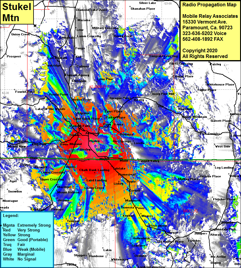 Stukel Mtn Coverage |
| Latitude: | 042 06 01.1N | 42.1003056 |
| Longitude: | 121 38 07.5W | -121.6354167 |
| Feet | Meters | |
| Ground Elevation: | 6528.0 | 1989.7 |
| HAAT: | 2243.4 | 683.8 |
| City: | Stukel | |
| County: | Klamath | |
| State: | Oregon |
This is not an MRA Owned Site. For space rental contact the site owner.
Do you own or manage this site? Click Here
Would you like to add a site to the Google Earth Map?? Click Here
Site Coverage: Coverage of Stukel, Klamath Falls, Altamont, Texum, Henley, Gem, Hosley, Lost River, Merrill, Tulelake, Homestead, Cornell, Mammoth, Perez, Tionesta, Mearles, Kephart, Canby Cross, Fleener Place, Laird Landing, Chalk Bank Landing, Midland, Worden, Dorris, MacDoel, Somerset, Mount Hebron, Jerome, Kegg, Bray, Tennant, Cougar, Grass Lake, Erickson, Penoyar, Upper Crossing, Lower Crossing, Gills, Dorris, Beswick, Dixie, Dorris, Worden, Keno, King Cole, Rocky Point, Shady Pine, Modoc Point, Algoma, Chiloquin, Klamath Agency, Lone Pine, Sprague River, Egert Place, Parker Place, Schmore Place, Moyina, Dairy, Bonanza, Lorella, Hot Springs, Beatty, Ivory Pine Mill, Blaisdel, Quartz Mtn, Langell Valley and more …..