Table Mtn III
| Site Name: | Table Mtn III | 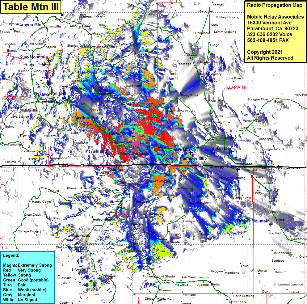 Table Mtn III Coverage |
| Latitude: | 042 11 51.9N | 42.1977500 |
| Longitude: | 122 29 33.2W | -122.4925556 |
| Feet | Meters | |
| Ground Elevation: | 6123.0 | 1866.3 |
| HAAT: | 1984.6 | 604.9 |
| City: | Klamath Jct | |
| County: | Jackson | |
| State: | Oregon |
This is not an MRA Owned Site. For space rental contact the site owner.
Do you own or manage this site? Click Here
Would you like to add a site to the Google Earth Map?? Click Here
Site Coverage: Coverage of Mistletoe, Ashland, Talent, Phoenix, Voorhies, Medford, Jacksonville, Seven Oaks, Applegate, Gold Hill, Sams Valley, White City, Eagle Point, Table Rock, Brownsboro, Lakecreek, Climax, Shale City, Lake of the Woods, Klamath Jct, Mount View, Pinehust, King Cole, Dixie, Steinman, Cole, Hilt, Hornbrook, Henley, Copco, Upper Crossing, Lower Crossing, Grants Pass, Merlin, Prospect, Fourbit Ford, Rocky Point, Klamath Agency, Chiloquin, Ft Klamath, Calimus, Kirk, Modoc Point, Algoma, Shady Pine, Wocus, Klamath Falls, Altamont, Texum, Pine Grove, Henley, Gem, Midland, Teeters Landing, Worden, Dorris, Somerset, Macdoel, Mount Hebron, Chalk Bank Landing, Jerome, Cougar, Big Springs, Little Shasta, Grenada, Montague, Snowdon, Ager, Hawkinsville, Yreka