Umatilla
| Site Name: | Umatilla | 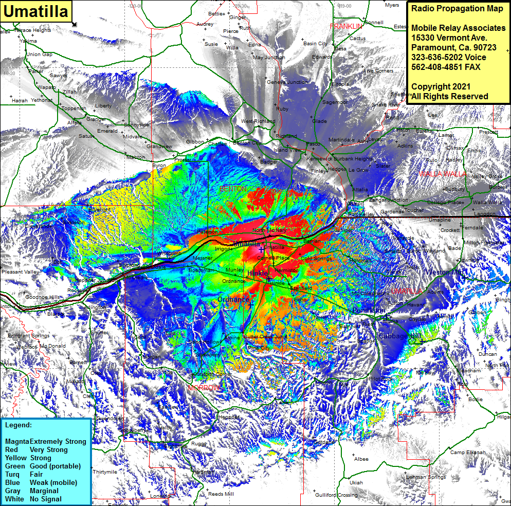 Umatilla Coverage |
| Latitude: | 045 53 38.2N | 45.8939444 |
| Longitude: | 119 20 53.0W | -119.3480556 |
| Feet | Meters | |
| Ground Elevation: | 619.0 | 188.7 |
| HAAT: | 140.0 | 42.7 |
| City: | Umatilla | |
| County: | Umatilla | |
| State: | Oregon |
This is not an MRA Owned Site. For space rental contact the site owner.
Do you own or manage this site? Click Here
Would you like to add a site to the Google Earth Map?? Click Here
Site Coverage: Coverage of Umatilla, Plymouoth, North McNary, Berrian, Cold Springs Jct, Charlestown, Cold Springs, Herriston, Hinkle, Stanfield, Bucks Corner, Murray, Cornell Place, Irrigon, Paterson Junction, Paterson, Messner, Whitcomb, Boardman, Clarke, Munley, Ordnance, Westland, Castle, Sixprong, McCredie, Heppner Junction, Willows, Moona, Benton City, Badgert Mountain, Badger, West Highlands, Island View, Kennewick, Pasco, Hedges, Finley, Glade, Sagemoor, Martindale, Ash, Levey, Redd, Snake River, Bubank Heights, Le Grow, Slater, Welland, Adkins, Hatch, Eureka, Babcock, Lee, Elwood, Climax, Rulo, Zangar Jct, Gardena, Touchet, Lowden, Sudbury, Walla Walla, Langdon, Mojonnier, College Place, Harbert, Ferndale, Umapine, Prunedale, Cobb, Milton-Freewater, Blue Mountain, Downing, Adams, Havana, Mission, Minthorn, Vinson