Vale
| Site Name: | Vale | 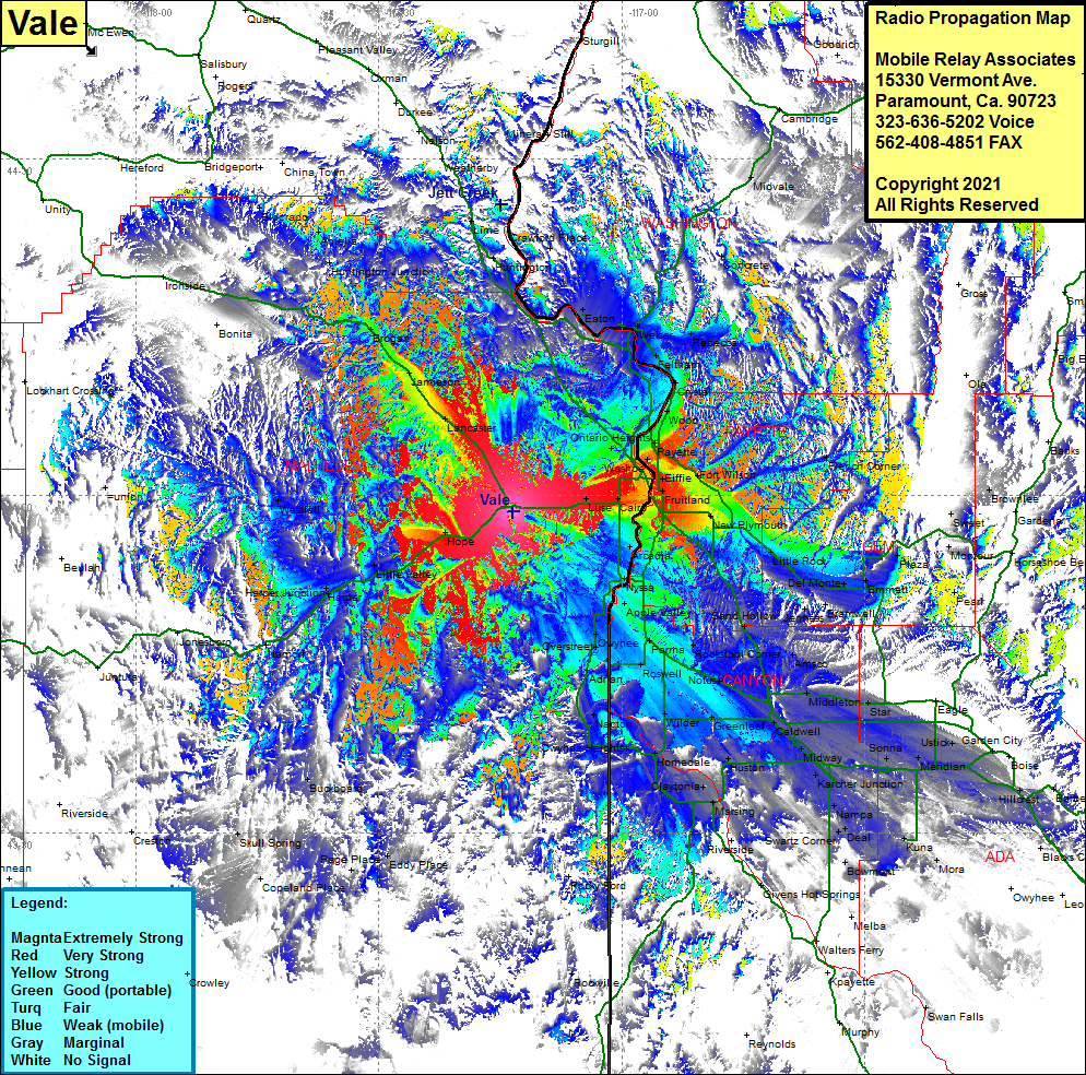 Vale Coverage |
| Latitude: | 043 58 37.5N | 43.9770833 |
| Longitude: | 117 13 24.7W | -117.2235278 |
| Feet | Meters | |
| Ground Elevation: | 2945.0 | 897.6 |
| HAAT: | 486.9 | 148.4 |
| City: | Cairo | |
| County: | Malheur | |
| State: | Oregon |
This is not an MRA Owned Site. For space rental contact the site owner.
Do you own or manage this site? Click Here
Would you like to add a site to the Google Earth Map?? Click Here
Site Coverage: Coverage of Overstreet, Owyhee, Parma, Adrian, Napton, Owyhee Heights, Homedale, Huston, Claytonia, Marsing, Givens Hot Springs, Walters Ferry, Melba, Bowmont, Swartz Corner, Kuna, Mora, Amsco, Middleton, Star, Sonna, Caldwell, Greenleaf, Midway, Karcher Jct, Nampa, Bowmont, Melba, Star, Ustick Meridian, Hillcrest, Barber, Rocky Ford, Rockville, Buckboard, Page Place, Eddy Place, Copeland Place, Skull Spring, Namorf, Harper Junction, Harper, Little Valley, Hope, Westfall, New Plymouoth, Little Rock, Del Monte, Jenness, Emmett, Plaza, Pearl, Montour, Sweet, Ironside, Bonita, Brogan, Jamieson, Lancaster, Ontario Heights, Ingard, Luse, Fruitland, Payette, French Corner, Brownlee, Wood, Crystal, Feltham, Rebecca, Weiser, Concrete, Midvale, Cambridge, Goodrich, Eaton, Huntington, Lime, Mineral, Still, Nelson, Huntinnton Heights, Amelia, Eldorado