Vinyard
| Site Name: | Vinyard | 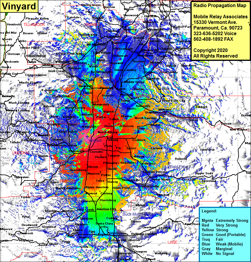 Vinyard Coverage |
| Latitude: | 044 38 25.4N | 44.6403889 |
| Longitude: | 123 16 32.9W | -123.2758056 |
| Feet | Meters | |
| Ground Elevation: | 1453.0 | 442.9 |
| HAAT: | 1033.9 | 315.1 |
| City: | Lewisburg | |
| County: | Benton | |
| State: | Oregon |
This is not an MRA Owned Site. For space rental contact the site owner.
Do you own or manage this site? Click Here
Would you like to add a site to the Google Earth Map?? Click Here
Site Coverage: Coverage of Corvallis, Oakville, Shrock, Bellfountain, Greenberry, Munson, Tulsa, Monroe, Lancaster, Bear Creek, Junction City, Santa Clara, Eugene, Finn, Veneta, Elmira, Noti, Goldson, Bear Creek, Horton, Harrisburg, Cartney, Halsey, Shedd, Painview, Targent, Fry, Pritle, Albank, Spicer, Lebanon, Waterloo, Santiam Terrace, Sweet Home, Sodaville, Cascadia, Union Point, Brownsville and more …..