Winchester
| Site Name: | Winchester | 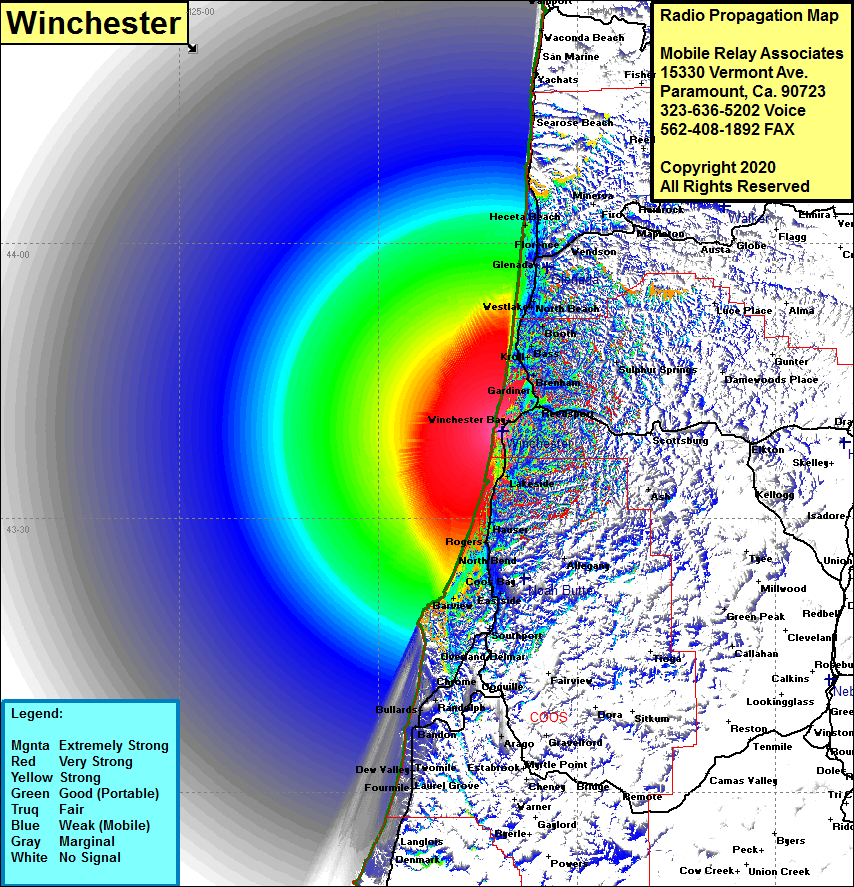 Winchester Coverage |
| Latitude: | 043 39 25.1N | 43.6569722 |
| Longitude: | 124 11 14.2W | -124.1872778 |
| Feet | Meters | |
| Ground Elevation: | 497.0 | 151.5 |
| HAAT: | 483.4 | 147.3 |
| City: | Winchester Bay | |
| County: | Douglas | |
| State: | Oregon |
This is not an MRA Owned Site. For space rental contact the site owner.
Do you own or manage this site? Click Here
Would you like to add a site to the Google Earth Map?? Click Here
Site Coverage: Coverage of Winchester Bay, Reedsport, East Grrdiner, Franz, Gardiner, Brenham, Kroll, Bass, Booth, Ada, Westlake, North Beach, Siboco, Heceta Beach, Heceta Jct, Tharp, Lakeside, Shutter Landing, Hauser, Rogers, Cordes, Allegany, Dellwood, North Bend, Empire, Telegraph Hill, Bunker Hill, Englewood, Barview, Libby, Charleston, Millington, Southport, Sumner, Delmar, Leneve, Bullards, Bandon, Winterville, Twomile, Dew Valley, Laurel Grove, Fourmile, Langlois, Denmark