Wolf
| Site Name: | Wolf | 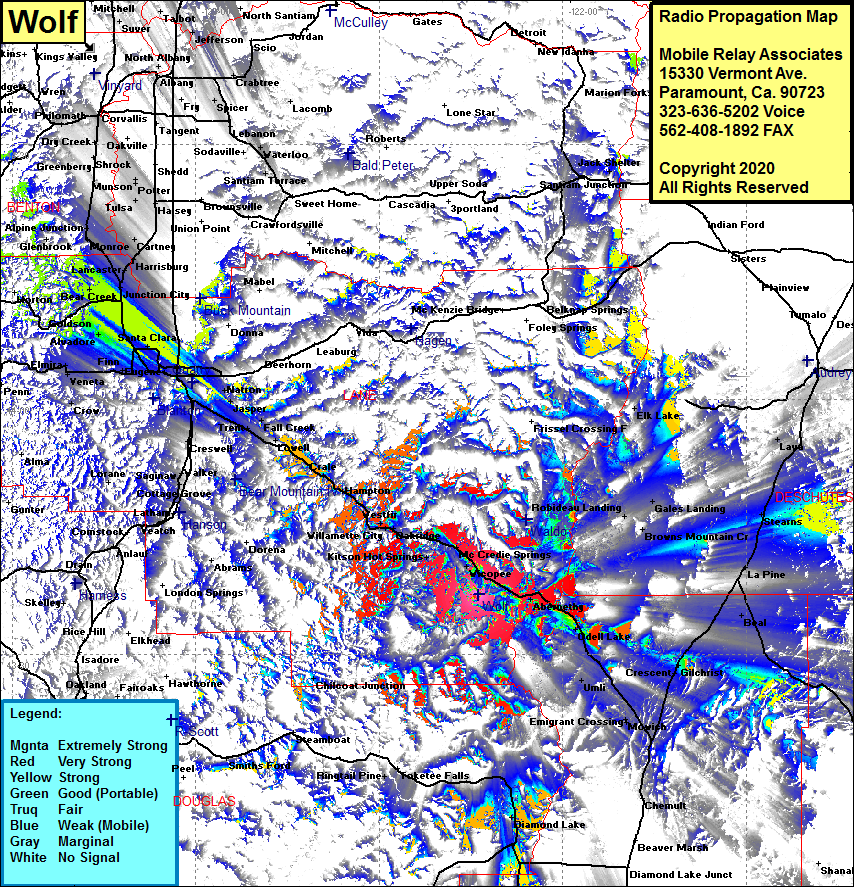 Wolf Coverage |
| Latitude: | 043 37 00.6N | 43.6168333 |
| Longitude: | 122 13 49.3W | -122.2303611 |
| Feet | Meters | |
| Ground Elevation: | 6447.0 | 1965.0 |
| HAAT: | 2242.3 | 683.5 |
| City: | Frazier | |
| County: | Lane | |
| State: | Oregon |
This is not an MRA Owned Site. For space rental contact the site owner.
Do you own or manage this site? Click Here
Would you like to add a site to the Google Earth Map?? Click Here
Site Coverage: Coverage of Fields, Abernethy, Odell Lake, Crescent, Movich, Emigrant Crossing, Gilchrist, Beal, LaPine, Stearns, Lava, Fort Rock, Christmas Valley, Chemult, Chilcoat Junction, Oakridge, Willamette City, Westfir, Hemlock, Framption, Drale, Monnow, Lowell, Pleasant Hill, Goshen, Natron, Springfield, Santa Clara, Fir Grove, Awbrey, Alvadore, Cheshire, Bear Creek, Goldson