Anacapa Lighthouse
| Site Name: | Anacapa Lighthouse | 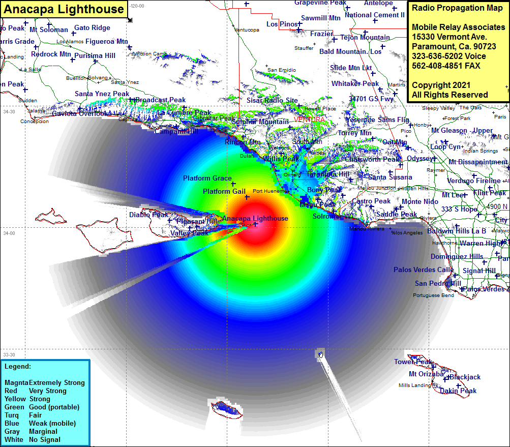 Anacapa Lighthouse Coverage |
| Latitude: | 034 00 57.2N | 34.0158889 |
| Longitude: | 119 21 34.0W | -119.3594444 |
| Feet | Meters | |
| Ground Elevation: | 229.0 | 69.8 |
| HAAT: | 327.4 | 99.8 |
| City: | Anacapa Island | |
| County: | Ventura | |
| State: | California |
This is not an MRA Owned Site. For space rental contact the site owner.
Do you own or manage this site? Click Here
Would you like to add a site to the Google Earth Map?? Click Here
Site Coverage: Coverage of Anacapa Island, portions of Santa Cruz Island, San Nicolas Island and Santa Barbara Island, Platform Gail, Platform Grace, Silver Strand, Port Hueneme, Hollywood Beach, Oxnard, Leesdale, Springville, Nyland, El Rio, Kimball, West Saticoy, Pierpont Bay, Ventura, Chrisman, Dulah, Sea Cliff, Punta Gorda, Punta, Weldons, Casitas Springs, Oak View, Mira Monte, Limoneira, Santa Paula, Somis, Lagol, Camarillo, Solomar, Trancas, Point Magu
Amateur (ham) frequencies: