Atolia
| Site Name: | Atolia | 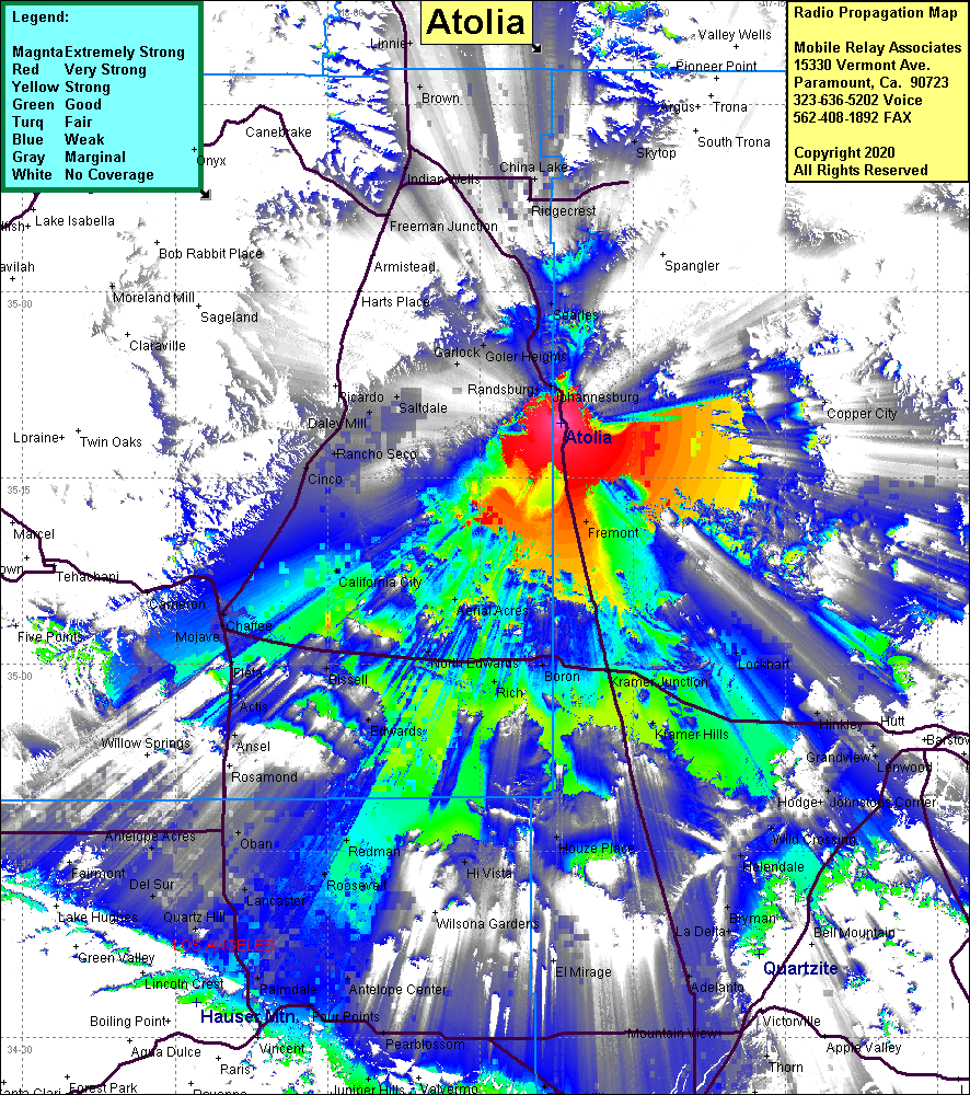 Atolia Coverage |
| Latitude: | 035 19 27.0N | 35.3241667 |
| Longitude: | 117 37 05.0W | -117.6180556 |
| Feet | Meters | |
| Ground Elevation: | 3676.2 | 1120.5 |
| HAAT: | 571.1 | 174.1 |
| City: | Atolia | |
| County: | San Bernardino | |
| State: | California |
This is not an MRA Owned Site. For space rental contact the site owner.
Do you own or manage this site? Click Here
Would you like to add a site to the Google Earth Map?? Click Here
Site Coverage: Coverage of Red Mountain, Fremont, Johanesburg, Goler Heights, Searles, Ridgecrest, Freeman Jct, Caneda, Saltdale, Gypsite, Daley Mill, Kramer Jct, Kramer Hills, Boron, Rich, North Edwards, Redman, Mojave, Chaffee, Cinco, Cantil, Indian Wells, Little Lake, Lockhart, Wild Crossing, Aerial Acres, California City
Amateur (ham) frequencies: