Barley Flats
| Site Name: | Barley Flats | 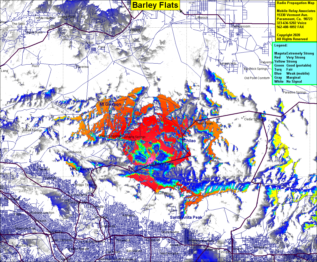 Barley Flats Coverage |
| Latitude: | 034 16 38.4N | 34.2773333 |
| Longitude: | 118 04 22.3W | -118.0728611 |
| Feet | Meters | |
| Ground Elevation: | 5603.7 | 1708.0 |
| HAAT: | 1762.5 | 537.2 |
| City: | Azusa | |
| County: | Los Angeles | |
| State: | California |
This is not an MRA Owned Site. For space rental contact the site owner.
Do you own or manage this site? Click Here
Would you like to add a site to the Google Earth Map?? Click Here
Site Coverage: Coverage of Angeles Crest Highway in the Barley Flats area, Singing Springs, Hidden Springs
Amateur (ham) frequencies: