Black Mtn II
| Site Name: | Black Mtn II | 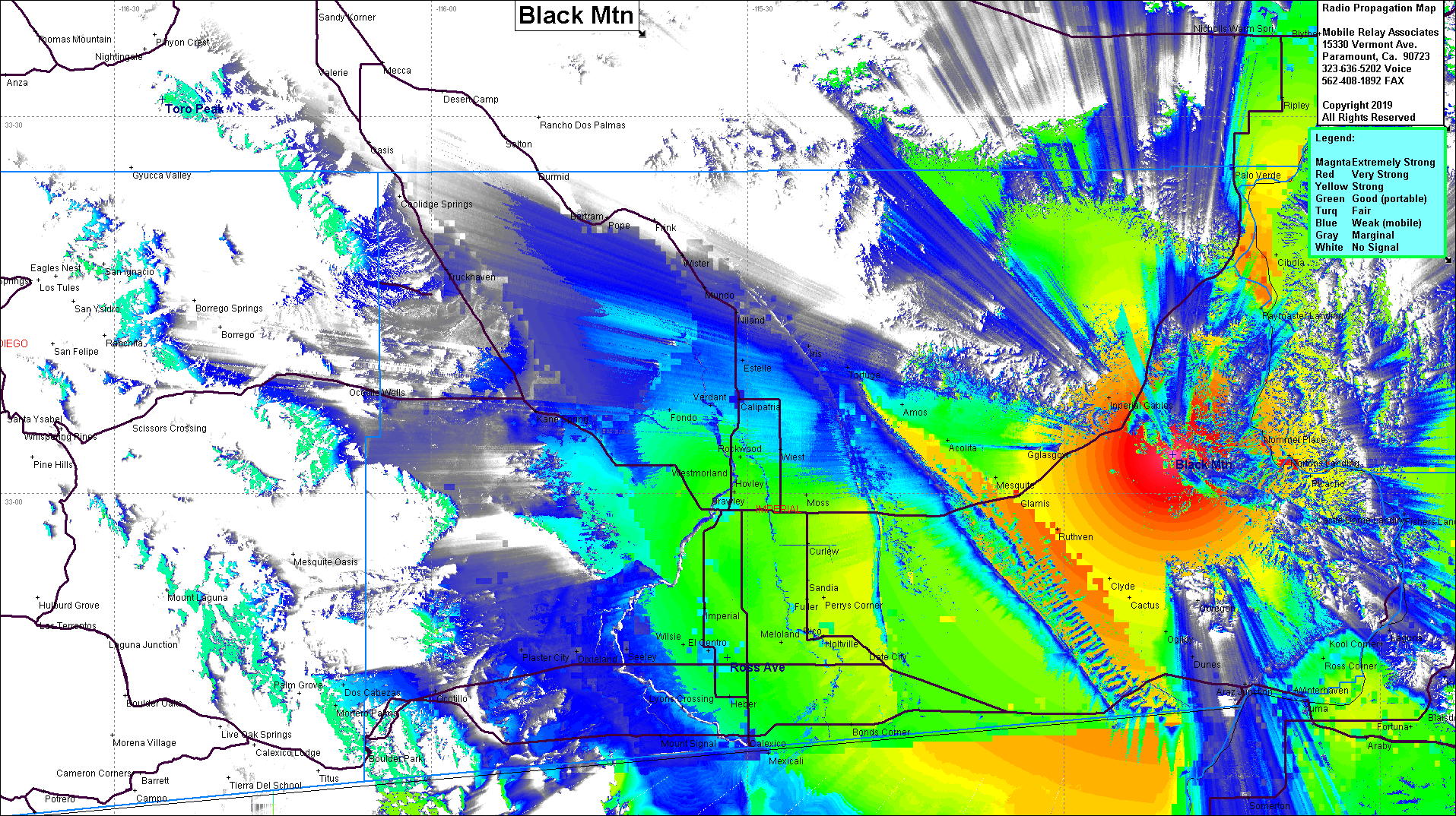 Black Mtn II Coverage |
| Latitude: | 033 03 05.5N | 33.0515278 |
| Longitude: | 114 49 40.1W | -114.8278056 |
| Feet | Meters | |
| Ground Elevation: | 2,058.7 | 627.5 |
| HAAT: | 1,246.8 | 380.0 |
| City: | Glamis | |
| County: | Imperial | |
| State: | California |
This is not an MRA Owned Site. For space rental contact the site owner.
Do you own or manage this site? Click Here
Would you like to add a site to the Google Earth Map?? Click Here
Site Coverage: Coverage of Brawley, El Centro, Calexico, Mexicali, Sandia, Clyde, Glamis, Yuma, Fortuna, Norton Landing, Ripley, Blythe, Mesquite, Acolita, Amos Estelle
Amateur (ham) frequencies: