BLT
| Site Name: | BLT | 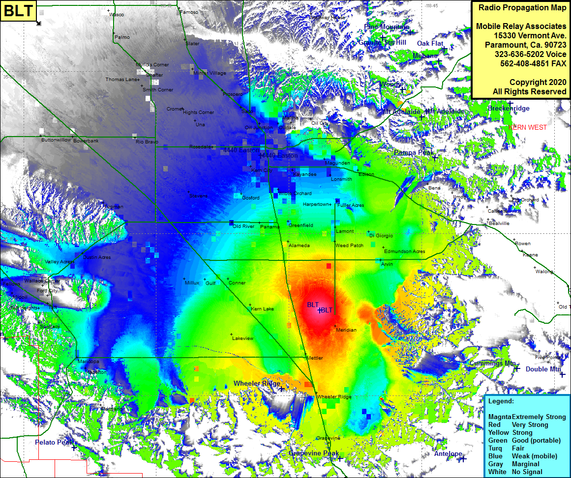 BLT Coverage |
| Latitude: | 035 07 55.2N | 35.1320000 |
| Longitude: | 118 56 30.4W | -118.9417778 |
| Feet | Meters | |
| Ground Elevation: | 359.0 | 109.4 |
| HAAT: | 6.1 | 1.9 |
| City: | Mettler | |
| County: | Kern | |
| State: | California |
This is not an MRA Owned Site. For space rental contact the site owner.
Do you own or manage this site? Click Here
Would you like to add a site to the Google Earth Map?? Click Here
Site Coverage: Coverage of Meridian, Mettler, Wheeler Ridge, Grapevine, Lakeview, Millux, Gulf, Conner, Old River, Alameda, Weed Patch, Edmundson Acres, Arvin, Fuller Acres, Harpertown, Orchard, Lonsmith, Gosford, Kern City, Bakersfield, Magunden, Oil City, Oildale, Maltha, Oil Jct, Crome, Rio Bravo, Buttonwillow, Dustin Acres, Valley Acres, Palmo, Myricks Corner, Minter Village Prospero
Amateur (ham) frequencies: