Boulder Park
| Site Name: | Boulder Park | 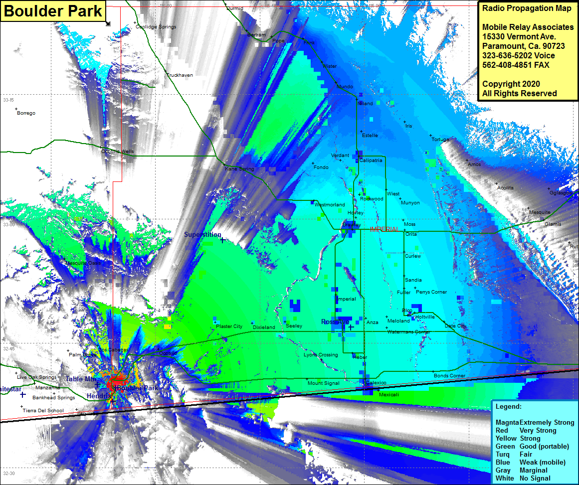 Boulder Park Coverage |
| Latitude: | 032 39 38.7N | 32.6607500 |
| Longitude: | 116 05 39.9W | -116.0944167 |
| Feet | Meters | |
| Ground Elevation: | 2887.0 | 880.0 |
| HAAT: | 617.4 | 188.2 |
| City: | Jacumba | |
| County: | Imperial | |
| State: | California |
This is not an MRA Owned Site. For space rental contact the site owner.
Do you own or manage this site? Click Here
Would you like to add a site to the Google Earth Map?? Click Here
Site Coverage: Coverage of Boulder Park, Mortero Palms, Dos Cabezas, Ocotillo, Hendrix, Coyote Wells, Plaster City, Dixieland, Edgas, Seeley, Wilsie, Mount Signal, Lyons Crossing, El Centro, Imperial, Anza, Meloland, Watermans Corner, Holtville, Perrys Corner, Fuller, Sandia, Durfew, Moss, Munyon, Orita, Moss, Alamorio, Westmorland, Rockwood, Hovley, Wiest, Calipatria, Tortuga, Amos, Glasgow, Mesquite, Glamis, Iria, Ruthven, Clyde, Cactus, Bonds Corner, Date City
Amateur (ham) frequencies: