Box Springs II
| Site Name: | Box Springs II | 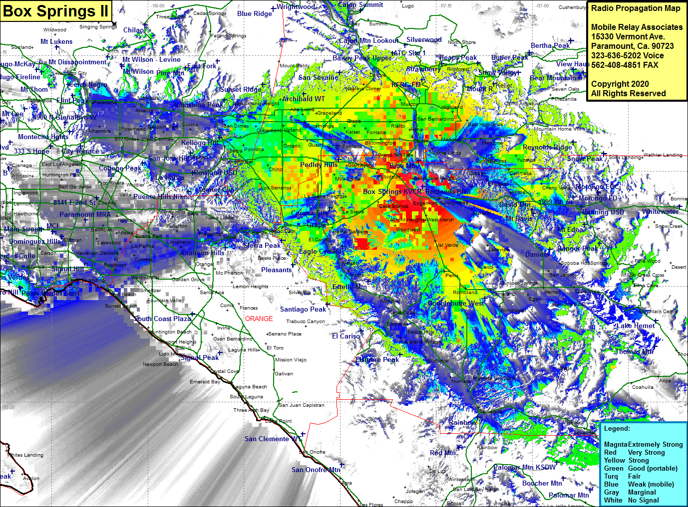 Box Springs II Coverage |
| Latitude: | 033 57 57.7N | 33.9660278 |
| Longitude: | 117 17 23.4W | -117.2898333 |
| Feet | Meters | |
| Ground Elevation: | 2956.0 | 901.0 |
| HAAT: | 1566.4 | 477.4 |
| City: | Riverside | |
| County: | Riverside | |
| State: | California |
This is not an MRA Owned Site. For space rental contact the site owner.
Do you own or manage this site? Click Here
Would you like to add a site to the Google Earth Map?? Click Here
Site Coverage: Coverage of the Riverside area and the inland empire including Riverside, Rubidoux, Lemona, Ennis, Sunnyslope, Crestmore, Highgrove, Grand Terrace, Colton, Rana, Rialto, San Bernardino, Highland, Del Rosa, Arrowhead Springs, Devore Heights, Nealeva Corner, Muscoy, Fontana, Kaiser, Grape, Grapeland, Alta Loma, San Antonia Heights, Claremont, Upland, Narod, Ontario, Pomona, Chino, Los Serranos, San Dimas, Prado Dam, Corona, May, La Sierra, Arlinton Station, Prenda, Arnold Heights, Woodcrest, Glen Valley, Val Verde, Perris, Romoland, Menifee, Sun City, Quail Valley, Homeland, Winchester, Nuevo, Yucaipa, Calimesa, Cherry Valley, Nicklin, Beaumont
Amateur (ham) frequencies: