Manzanita Mtn
| Site Name: | Manzanita Mtn | 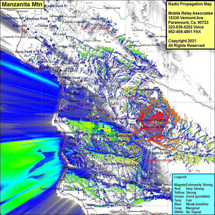 Manzanita Mtn Coverage |
| Latitude: | 034 53 38.8N | 34.8941111 |
| Longitude: | 120 04 50.0W | -120.0805556 |
| Feet | Meters | |
| Ground Elevation: | 3196.0 | 974.1 |
| HAAT: | 1151.0 | 350.8 |
| City: | Santa Maria | |
| County: | Santa Barbara | |
| State: | California |
This is not an MRA Owned Site. For space rental contact the site owner.
Do you own or manage this site? Click Here
Would you like to add a site to the Google Earth Map?? Click Here
Site Coverage: Coverage of Los Alamos, Los Olivos, Ballard, Sana Ynez, Solvang, Buelton, Cachuma Village, Las Creces, Honda, LaSalle, Lompoc, Baroda, Surf, Lompoc Landing, Tangair, Narlton, Antonio, Casmalia, Shuman, Waldorf, Bragur, Barsug, Pacer, Midco, Santa Maria, North Santa Maria, Nipomo, Berros, Huasna, Callendar, Bromela, Oseano, Pismo Beach, Grover City, Oaks, Edna, Verde, Shell Beach, Sycamore Springs, Avila Beach