Bullion Mtn
| Site Name: | Bullion Mtn | 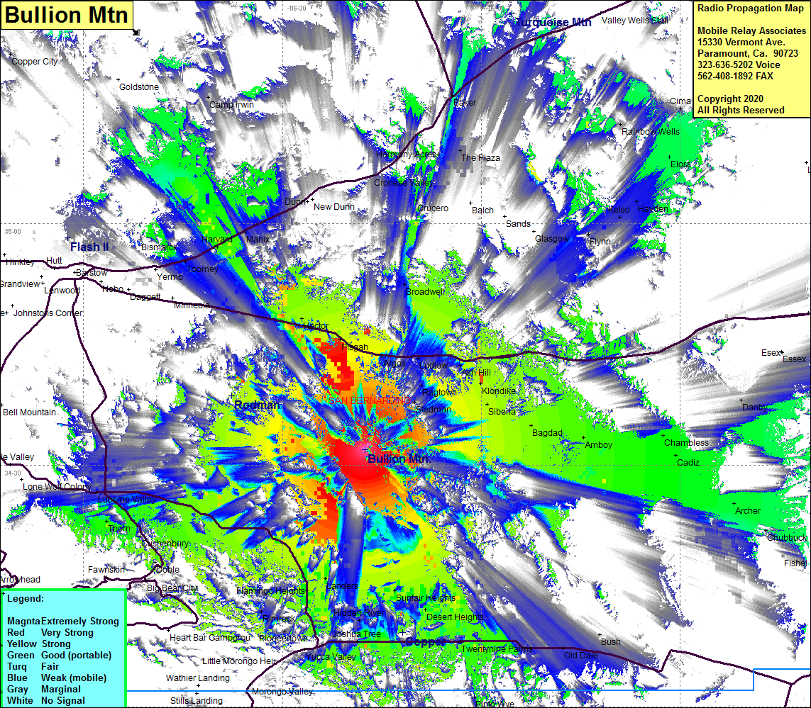 Bullion Mtn Coverage |
| Latitude: | 034 31 58.6N | 34.5329444 |
| Longitude: | 116 17 33.5W | -116.2926389 |
| Feet | Meters | |
| Ground Elevation: | 4698.2 | 1432.0 |
| HAAT: | 1845.5 | 562.5 |
| City: | Knondike | |
| County: | San Bernardino | |
| State: | California |
This is not an MRA Owned Site. For space rental contact the site owner.
Do you own or manage this site? Click Here
Would you like to add a site to the Google Earth Map?? Click Here
Site Coverage: Coverage of the High Desert east of Barstow, Hector, Pisgah, Lavac, Argos, Broadwell, Harvard, Ragtown, Knondike, Ash Hill, Siveria, Bagdad, Amboy, Sunfair Heights, Desert Heights, Twentynine Palms, Joshua Tree, Landers, Thom, Lucerne Valley
Amateur (ham) frequencies: