Burnt Peak
| Site Name: | Burnt Peak | 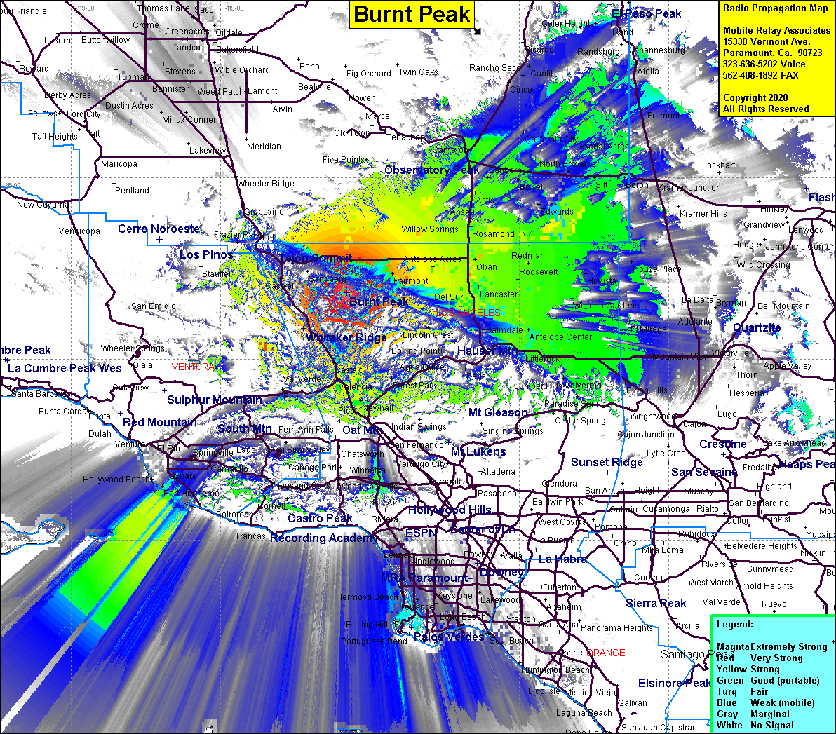 Burnt Peak Coverage |
| Latitude: | 034 40 56.6N | 34.6823889 |
| Longitude: | 118 34 36.4W | -118.5767778 |
| Feet | Meters | |
| Ground Elevation: | 5778.9 | 1761.4 |
| HAAT: | 2544.8 | 775.7 |
| City: | Lake Hughes | |
| County: | Los Angeles | |
| State: | California |
This is not an MRA Owned Site. For space rental contact the site owner.
Do you own or manage this site? Click Here
Would you like to add a site to the Google Earth Map?? Click Here
Site Coverage: Coverage of the High Desert west to Gorman, east to Kramer Junction, south to Largo Vista, north to Garlock, Hwy 14 to Cantil
Amateur (ham) frequencies: