Cajon Summit
| Site Name: | Cajon Summit | 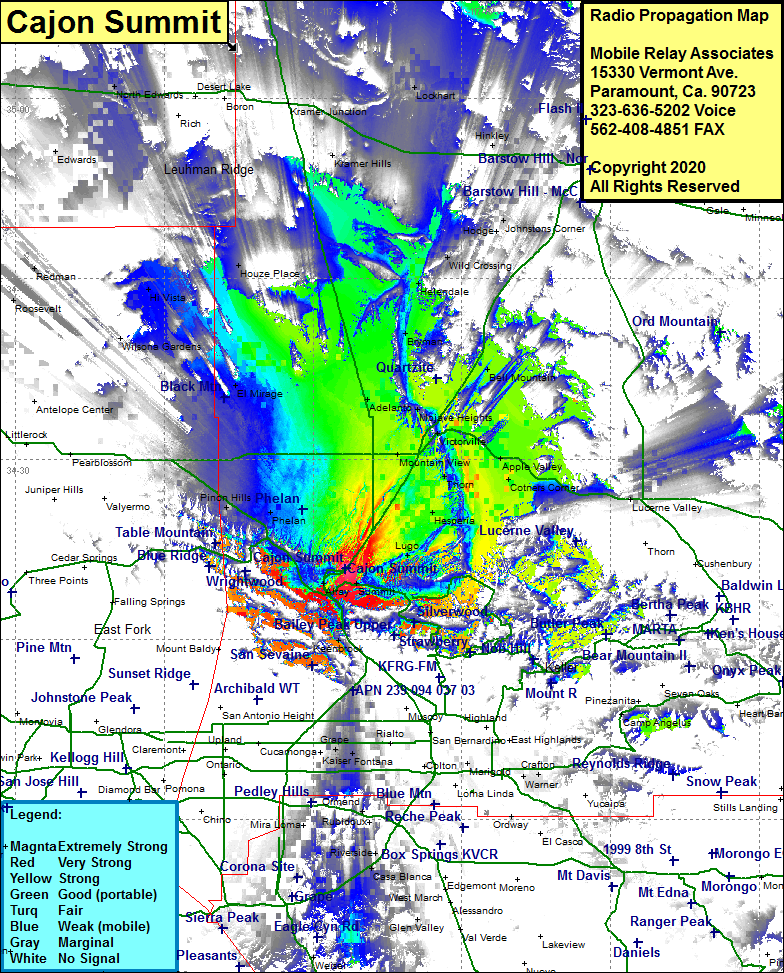 Cajon Summit Coverage |
| Latitude: | 034 20 54.2N | 34.3483889 |
| Longitude: | 117 26 45.3W | -117.4459167 |
| Feet | Meters | |
| Ground Elevation: | 4336.0 | 1321.6 |
| HAAT: | 483.8 | 147.5 |
| City: | Hesperia | |
| County: | San Bernardino | |
| State: | California |
This is not an MRA Owned Site. For space rental contact the site owner.
Do you own or manage this site? Click Here
Would you like to add a site to the Google Earth Map?? Click Here
Site Coverage: Coverage of the northern portion of the Cajon Pass, Silverlake, Cajon Junction, Summit, Cajon, Alray, Lugo, Hesperia, Mountain View, Phelan, Mountain Top Junction, Yucca Inn, Wrightwood, Victorville, Adelanto, Oro Grande, Pinion Hills, El Mirage, Bryman, WIld Crossing, Bell Mouontain
Amateur (ham) frequencies: