Campanil Hill
| Site Name: | Campanil Hill | 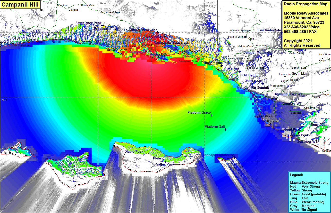 Campanil Hill Coverage |
| Latitude: | 034 24 55.9N | 34.4155278 |
| Longitude: | 119 45 03.0W | -119.7508333 |
| Feet | Meters | |
| Ground Elevation: | 595.0 | 181.4 |
| HAAT: | 103.0 | 31.4 |
| City: | Santa Barbara | |
| County: | Santa Barbara | |
| State: | California |
This is not an MRA Owned Site. For space rental contact the site owner.
Do you own or manage this site? Click Here
Would you like to add a site to the Google Earth Map?? Click Here
Site Coverage: Coverage of Santa Barbara, El Sereno, La Patera, Coromar, Ellwood, Montecito, Summerland, Serena, Sandyland Cove, Old Town, Carpinteria, Puma, Sea Cliff, Dulah, Ventura, Pierport Bay, Montalvo, Kimball, El Rio, Nyland, Springville, Leesdale, Oxnard, Hollywood Beach, Silver Strand, Port Hueneme, Capitan, Tajiguas, Lento, Gaviota, Fort Orford, San Augustine, Gato, Concepcion
Amateur (ham) frequencies: