Castle Rock II
| Site Name: | Castle Rock II | 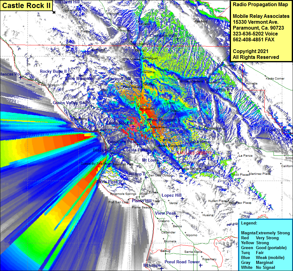 Castle Rock II Coverage |
| Latitude: | 035 28 04.6N | 35.4679444 |
| Longitude: | 120 43 50.7W | -120.7307500 |
| Feet | Meters | |
| Ground Elevation: | 1854.0 | 565.1 |
| HAAT: | 823.6 | 251.0 |
| City: | Atascadero | |
| County: | San Luis Obispo | |
| State: | California |
This is not an MRA Owned Site. For space rental contact the site owner.
Do you own or manage this site? Click Here
Would you like to add a site to the Google Earth Map?? Click Here
Site Coverage: Coverage of the Morro Bay area, Atascadero, Henry, Asuncion, Templeton, Linne, Creston, Garden Farms, Cushing, Santa Margarita, Paso Robles, Capital Hill, Oak Park, Wellsona, Estrella, San Miguel, Old Adobe, McKay, Naciemento, Valleton, Parkfield, Cholame, Shandon, Witley Gardens, Bradley, Cayucos, Cuesta-By-The-Sea, Baywood Park
Amateur (ham) frequencies: