Catalina Airport
| Site Name: | Catalina Airport | 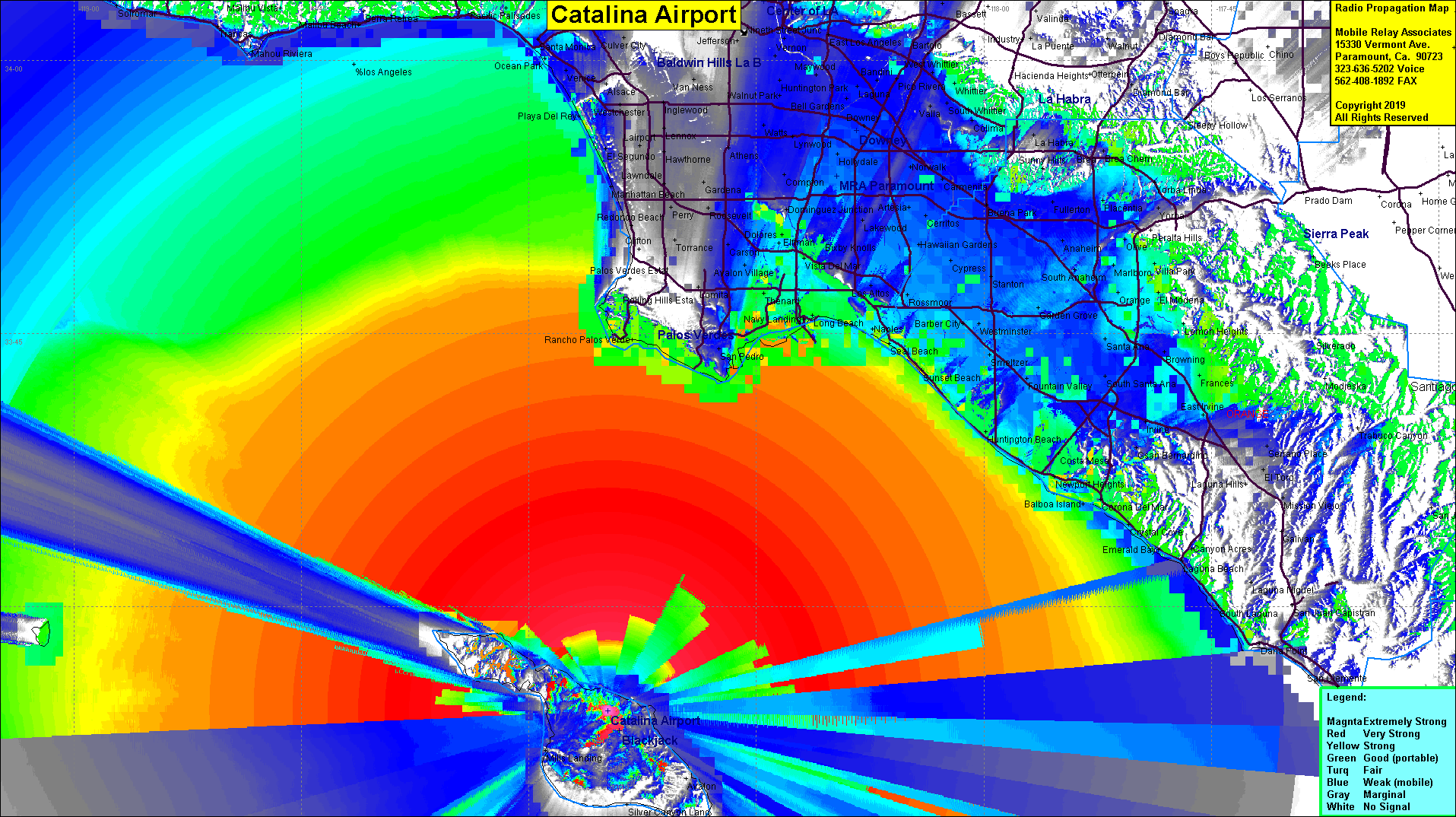 Catalina Airport Coverage |
| Latitude: | 033 24 08.4N | 33.4023333 |
| Longitude: | 118 24 53.8W | -118.4149444 |
| Feet | Meters | |
| Ground Elevation: | 1,551.8 | 473.0 |
| HAAT: | 1,381.1 | 421.0 |
| City: | Avalon | |
| County: | Los Angeles | |
| State: | California |
This is not an MRA Owned Site. For space rental contact the site owner.
Do you own or manage this site? Click Here
Would you like to add a site to the Google Earth Map?? Click Here
Site Coverage: Coverage of the LA County, Orange County, Ventura County and San Diego coastlines plus most of Catalina Island
Amateur (ham) frequencies: