Cerro Negro
| Site Name: | Cerro Negro | 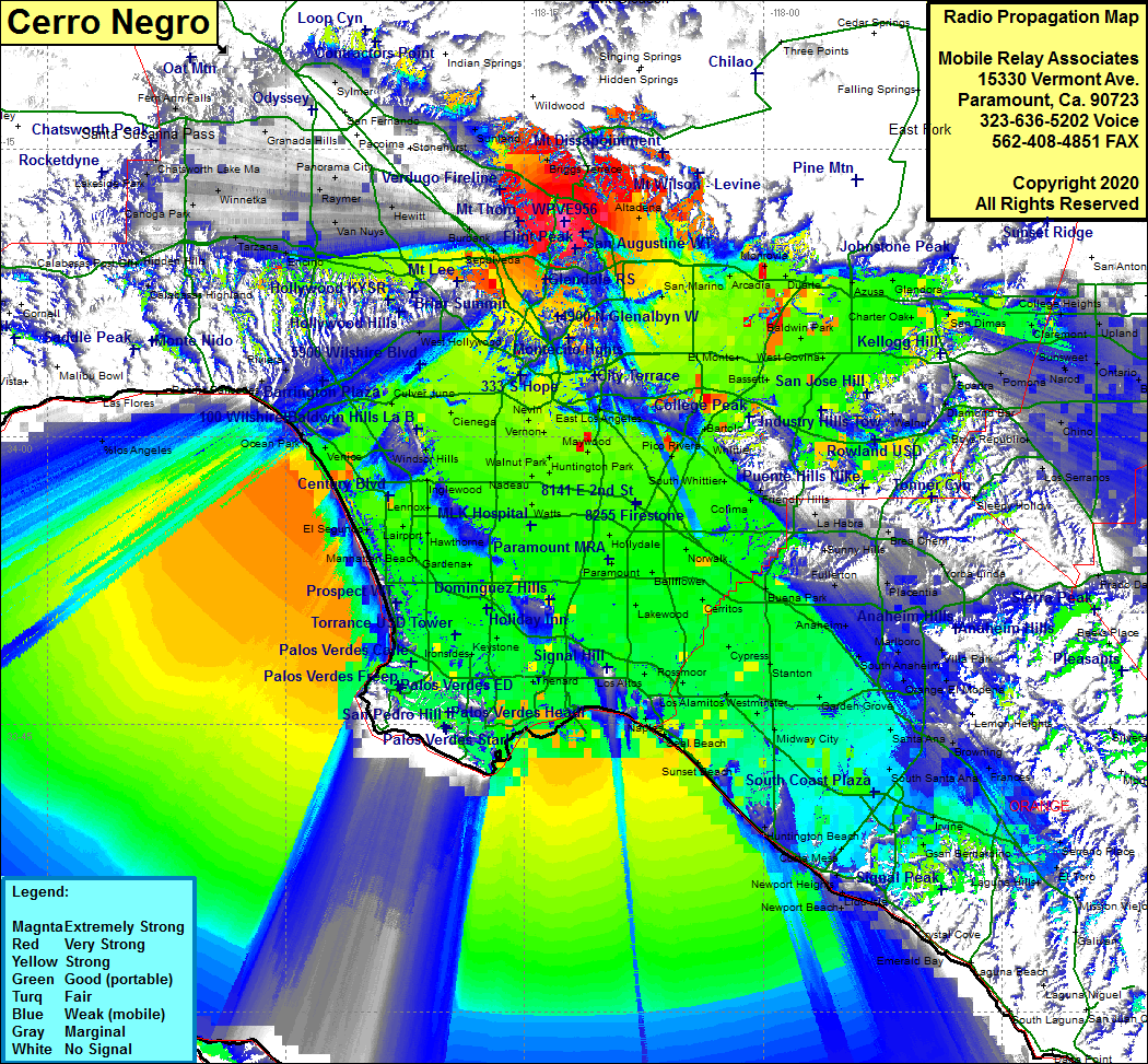 Cerro Negro Coverage |
| Latitude: | 034 11 15.0N | 34.1875000 |
| Longitude: | 118 12 28.3W | -118.2078611 |
| Feet | Meters | |
| Ground Elevation: | 1890.0 | 576.1 |
| HAAT: | 458.0 | 139.6 |
| City: | Glendale | |
| County: | Los Angeles | |
| State: | California |
This is not an MRA Owned Site. For space rental contact the site owner.
Do you own or manage this site? Click Here
Would you like to add a site to the Google Earth Map?? Click Here
Site Coverage: Coverage of La Crescenta, Altadena, Pasadena, Chapman, San Marino, Alhambra, Tujunga, Briggs Terrace, LA Basin, Southbay, Los Angeles, northwestern Orange County, San Gabriel Valley, Arcadia, Temple City, Baldwin Park, West Covina, El Monte, Industry, Rowland Heights, Covina, Irwindale, Azusa, Glendora, San Dimas, Claremont
Amateur (ham) frequencies: