Claremont Peak
| Site Name: | Claremont Peak | 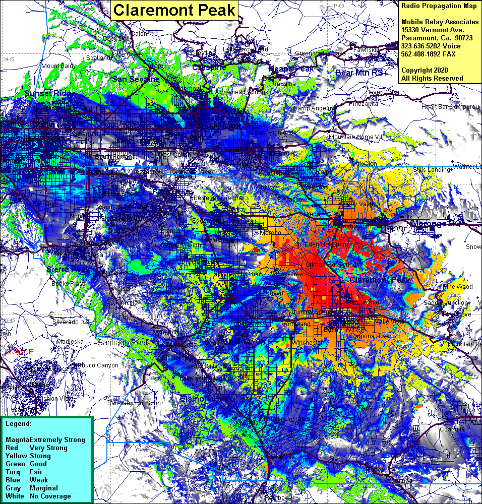 Claremont Peak Coverage |
| Latitude: | 033 49 46.7N | 33.8296389 |
| Longitude: | 116 57 12.8W | -116.9535556 |
| Feet | Meters | |
| Ground Elevation: | 3717.2 | 1133.0 |
| HAAT: | 1535.7 | 468.1 |
| City: | Hemet | |
| County: | Riverside | |
| State: | California |
This is not an MRA Owned Site. For space rental contact the site owner.
Do you own or manage this site? Click Here
Would you like to add a site to the Google Earth Map?? Click Here
Site Coverage: Coverage of San Jacinto, Hemet, Ramona Bowl, Winchester, Valle Vista, Gillman Hot Springs, Lakeview, Moreno, Edgemont, Romoland, Homeland, Sun City, Nuevo, Perris, Wildomar, Sage, Murrieta, Murrieta Hot Springs, Beaumont, Banning, Cherry Valley, Highland Springs, Hinda, Lakeview Hot Springs, Egan
Amateur (ham) frequencies: